|
|
|
||||||||||||||||
|
|
|
|
|
|
|
|
|
||||||||||
|
|
|
|
|||||||||||||||
|
|
|
||||||||||||||||
|
|
|
|
|
||||||||||||||
|
|
|
|
|
|
|
|
|
|
|
||||||||
|
|
|
|
|
|
|
||||||||||||
|
|
|
|
|
|
|
|
|
|
|
|
|
|
|
|
|
|
|
Day Trip Guide: Dripping Springs to Johnson City And Beyond
"Is There Such A Thing As Too Many Bluebonnets?", by Carol A. King
Slow Down, Seek The Art, Find Your Adventure...
Please help us bring more day trips to you. Order postcards for $1.15 or note cards for $2.95. (click links) Thank you.
|
Our blah blah, Links, and Directions |
Photo Art (or maps) By Carol |
|
Getting Started The lure of the wildflowers....AGAIN. Wander and photo lust takes control when I know everything is covered in bluebonnets and looks so 'purdee'. Decided to follow some of our favorite flower viewing roads to Johnson City and beyond. No dilly dallying over breakfast. I grabbed a breakfast taco at the corner market and Jimmie and I headed for the hills.
Trip put a little over 100 miles on the odometer and took all day. I took so many photos that I've now worn myself out working on them. THEREFORE, my 'blah blah' will be short clips intended to be semi-amusing, so I can get this done, and head BACK out on the roads!
Directions: From Austin, we headed west out 290 towards Dripping Springs. But BEFORE we got there, Jimmie wanted a breakfast taco, too, so we accidentally discovered a most inter-resting place we'd overlooked before... Senor Buddy's. It's almost 2 1/2 miles after crossing 71 on Hwy 290 west (just after the light for Circle Drive). |
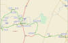
Map Overview of the Day Trip.
Map of first leg of trip. Austin to Yeager Creek Road.
|
|
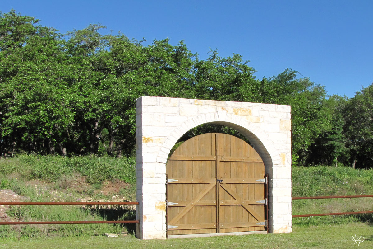
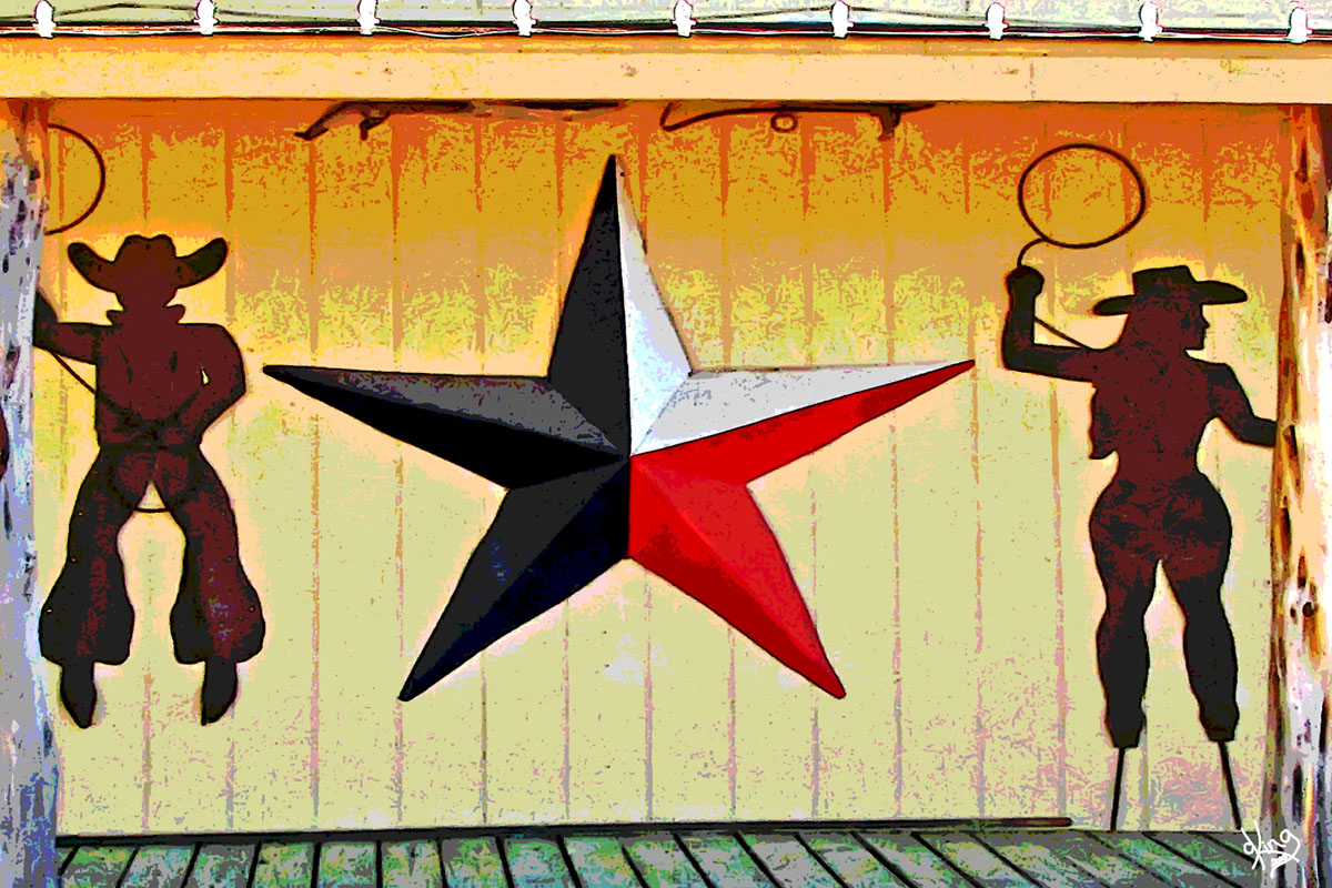
Senor Buddy's - a most interesting place! We love to have breakfast at Curra's in Austin and it just so happened Senor Buddy's on 290 had a sign saying it had tacos made by Curra's. Yay for Jimmie! And Yay for me, because while I waited on him to get his taco, I discovered that Senor Buddy's had a lot more to offer than tacos.
You'll have to stop by and check out their 'cool stuff' that is lying around everywhere, ....although the gate there appears to lead nowhere. Or, does it?
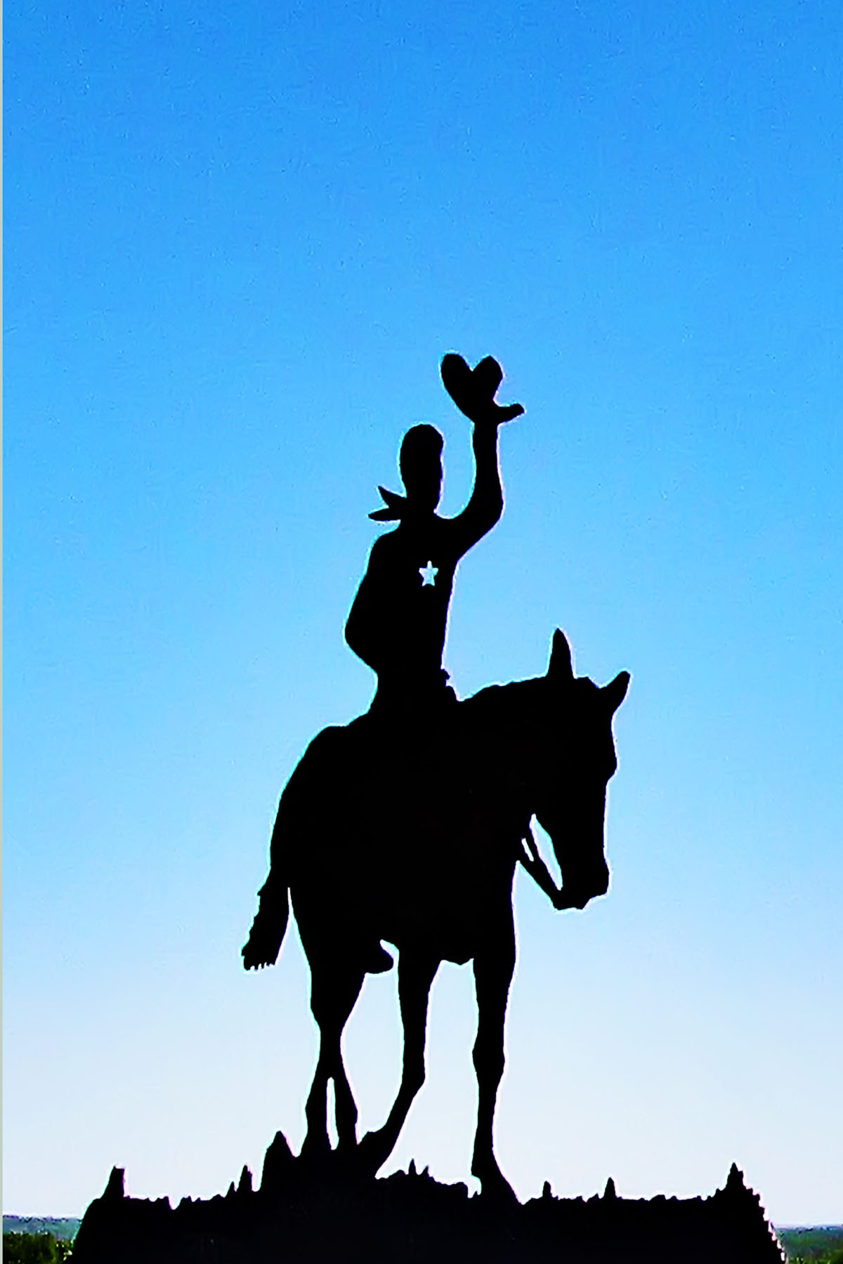
I know that the metal cowboys and cowgirls and stars are a common sight in Texas, and can get a little repetitive, but I always remember that it was a creative artist, or artists, that came up with these concepts in the first place, and that Texans love 'em! So, there you go... a very Texan postcard!
'Curra's Grill - 'The Mother of all Mex'
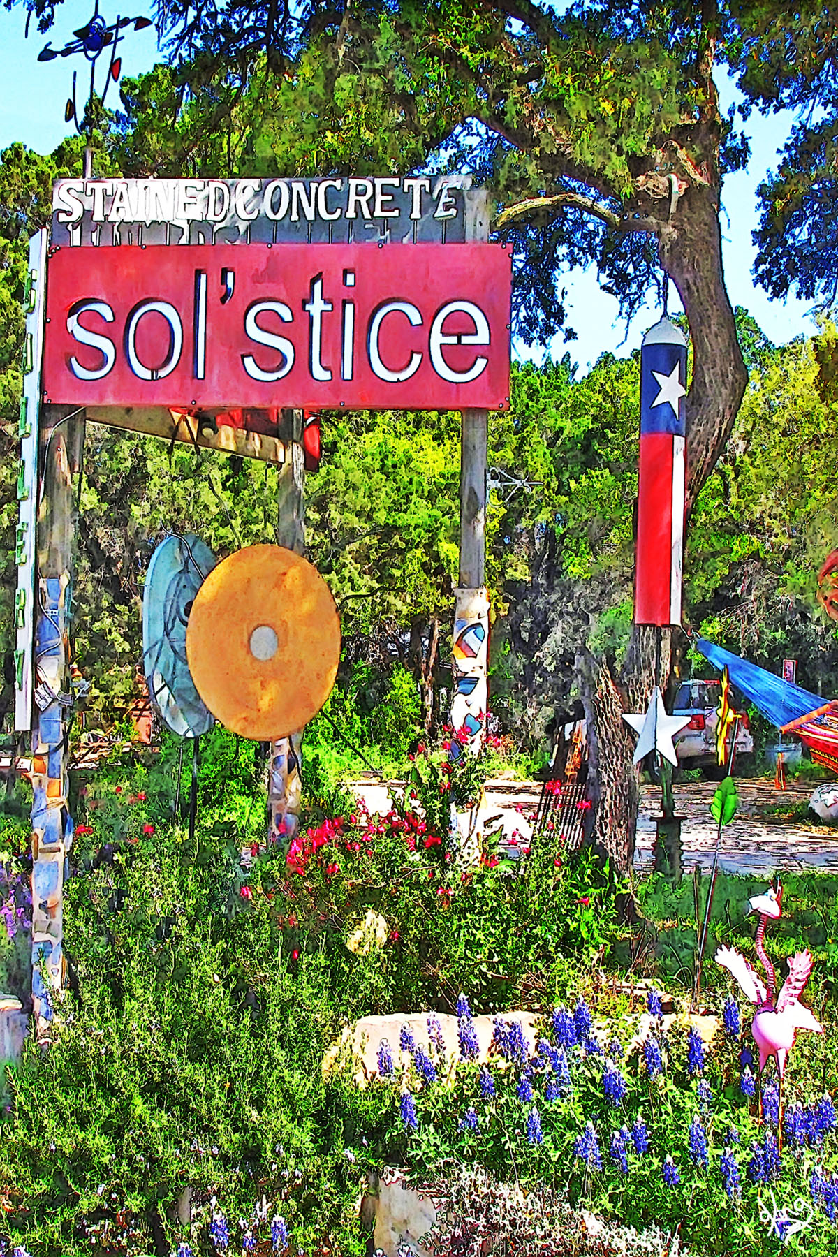
Directions: Continue west on Hwy 290 for a little over 11 miles and you will come to Dripping Springs. As you go through town, watch for the Sol'Stice sign on the right in less than a mile. It's worth a stop-in! |
|
|
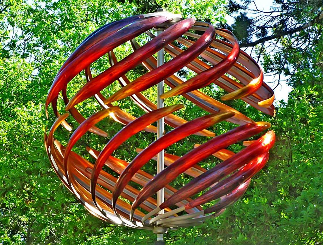
sol'stice garden expressions Our goal was to find bluebonnets, so did not have time to explore Dripping Springs today, but we just HAD to take a few moments and stop by Sol'Stice as a launching moment of zen (if you will). From their web site:
"OUR MISSION -Enrich peoples lives by providing
access to beautiful things. We specialize in kinetics and outdoor
sculpture, art, garden and outdoor living decor. We promote hand-crafted
merchandise created by inspired artists who make the ordinary
extraordinary through vision and passion. The most beautiful room of your
house is the one that is right outside your backdoor. Let us help you make
it wonderful. In addition to our array of outdoor living treasures, we
feature a rotating selection of work from area artists in our gallery room
and on the walls of our retail space. We look forward to seeing you soon.
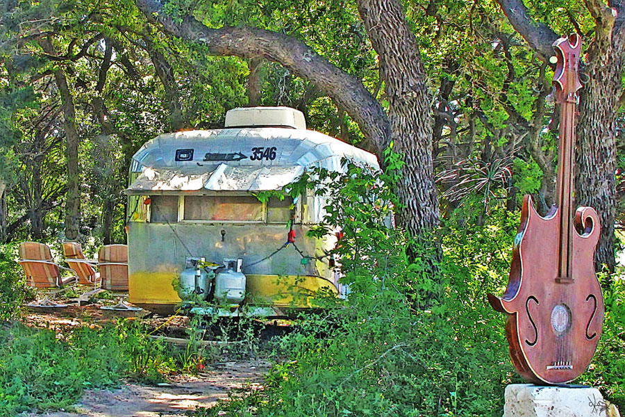
That trailer scene..... MY idea of a palace.
Dripping Springs, TX - Handbook of Texas
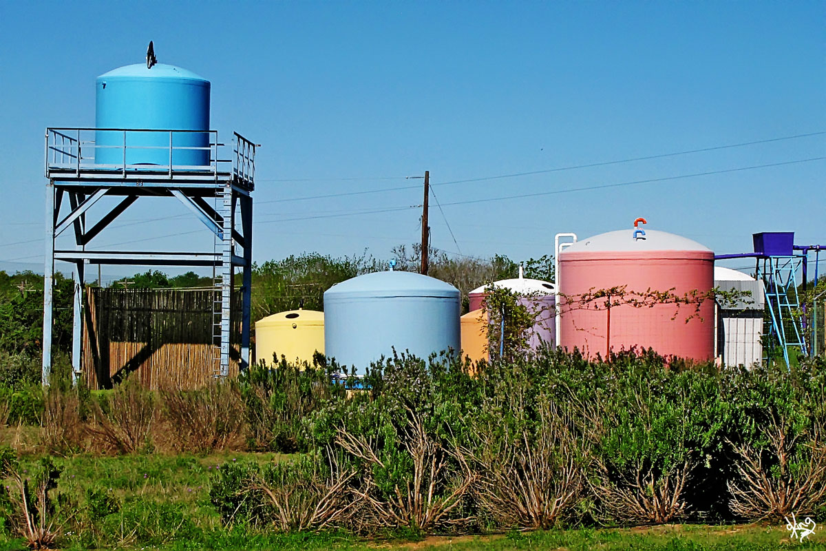
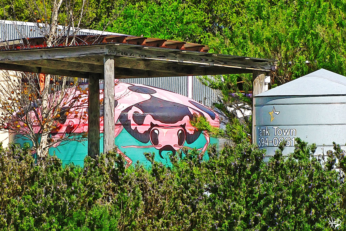
Directions: In order to have time to seek the wildflowers, we didn't stay to explore Dripping Springs this time. Continuing west on Hwy 290 out of Dripping Springs about 2 miles from Sol'Stice, we noticed some bluebonnets lurking down the Tank Town drive, so pulled in there for some perusal. |
Postcard, Note Card, or Wall Prints
Oh, and I 'borrowed' some of their art to make a card for University of Texas Longhorn fans! |
|
Tank Town, Dripping Springs, TX I had always noticed the rainbow of rainwater collection tanks off to the right while whizzing by on Hwy 290 west out of Dripping Springs, but THIS TIME some bluebonnets we spied gave us the incentive to stop and prowl.
Prison striped stockings.. No yellow-bellied fowl.
Tank Town - Rain Water Collection
Directions: From Tank Town, keep heading west on Hwy 290 a little over 5 miles to Henly. Be careful... you might miss it! |
|
|
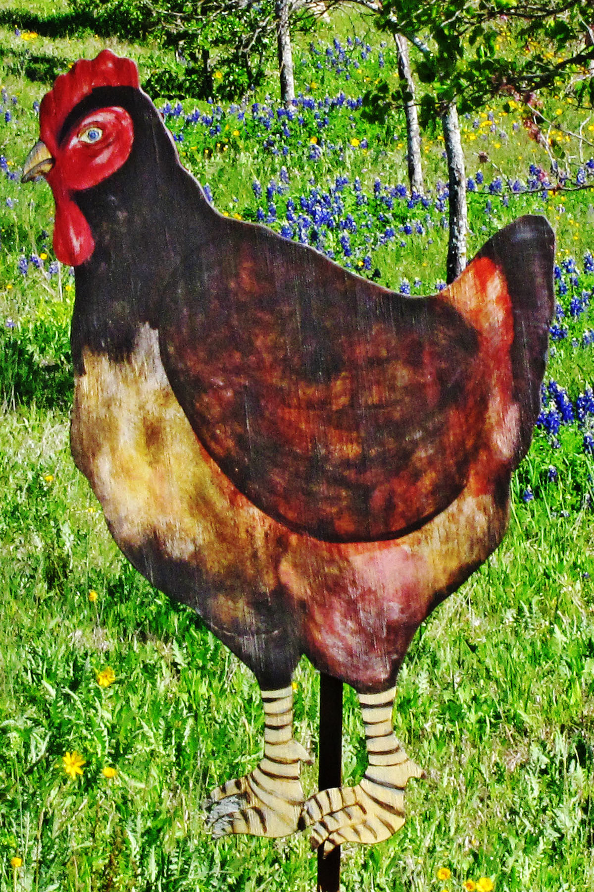
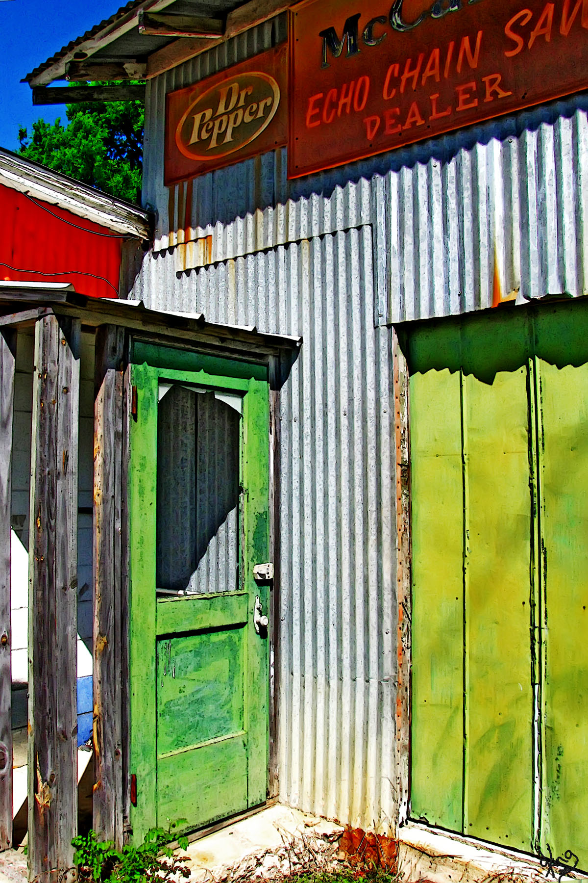
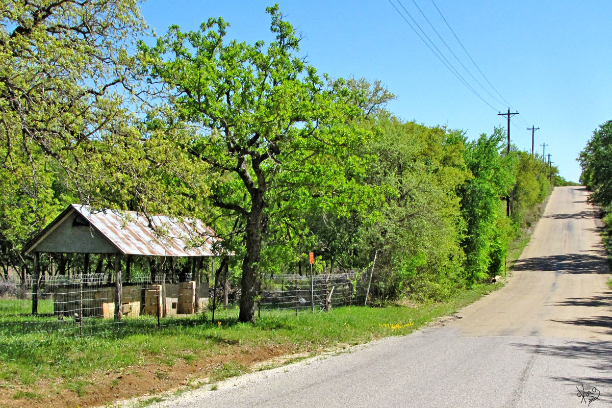
Finding the art in Henly, TX If you seek the art, you will find it!
No matter left, No matter right, No matter color, No matter height....
We all make bright.
(I feel like a kid writing 3rd grade poems... FUN!) |
Postcard, Note Card, or Wall Prints
|
|
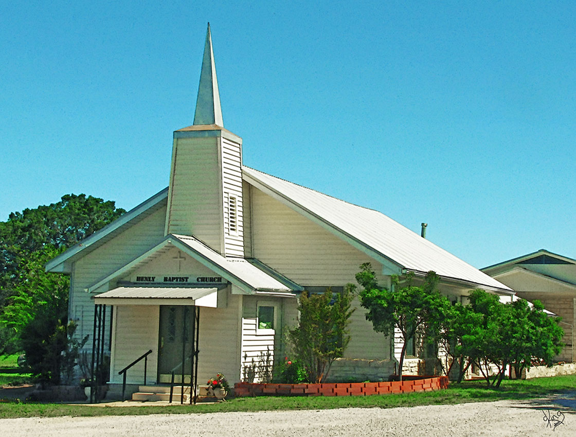
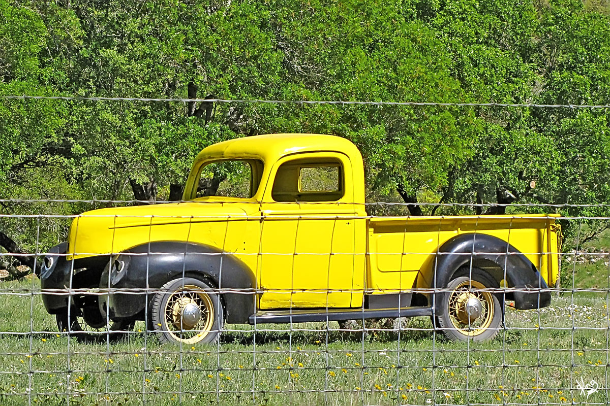
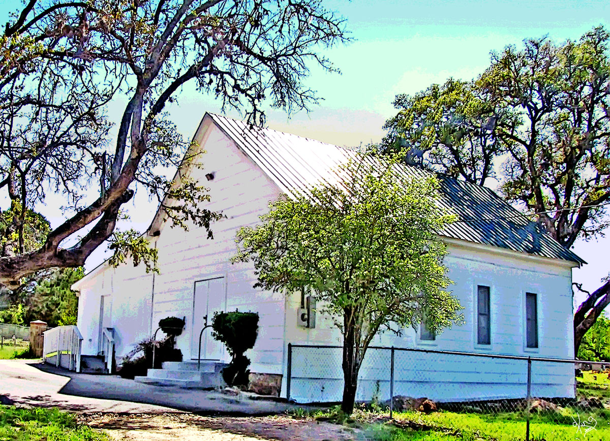
Henly, TX
Henly remains..
Henly, TX - By TexasEscapes.com
Henly Baptist Church web site
Postcard, Note Card, or Wall Prints Photo and Google Earth Location
That door... Razor edged warning of portals to nowhere...
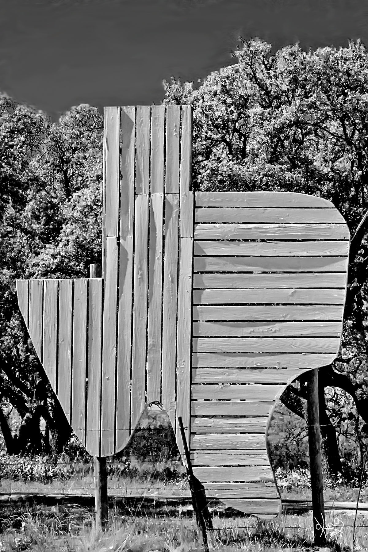
Directions: Continue heading west on Hwy 290. In a mile or so, you will cross from Hays County into Blanco County. In about 2 miles after that, watch for the wooden sign shaped like Texas on your left. It's always changing so who know what it'll look like when you see it. |
Postcard, Note Card, or Wall Prints
Postcard, Note Card, or Wall Prints
|
|
Texas Shapes I must think I'm going to make a coffee table book of Texas shapes, or I'm just a collector, because I capture the shape wherever I see it. Who knows... famous Texas Shapes book in my future?? :)
Directions: In about another 1 1/2 miles from the Texas shape on 290, you will cross Yeager Creek. About a mile past the creek, turn right on Yeager Creek Road (or County Road 202), and head north. (Yeager Creek Road is just under 6 miles from Henly.) |
|
|
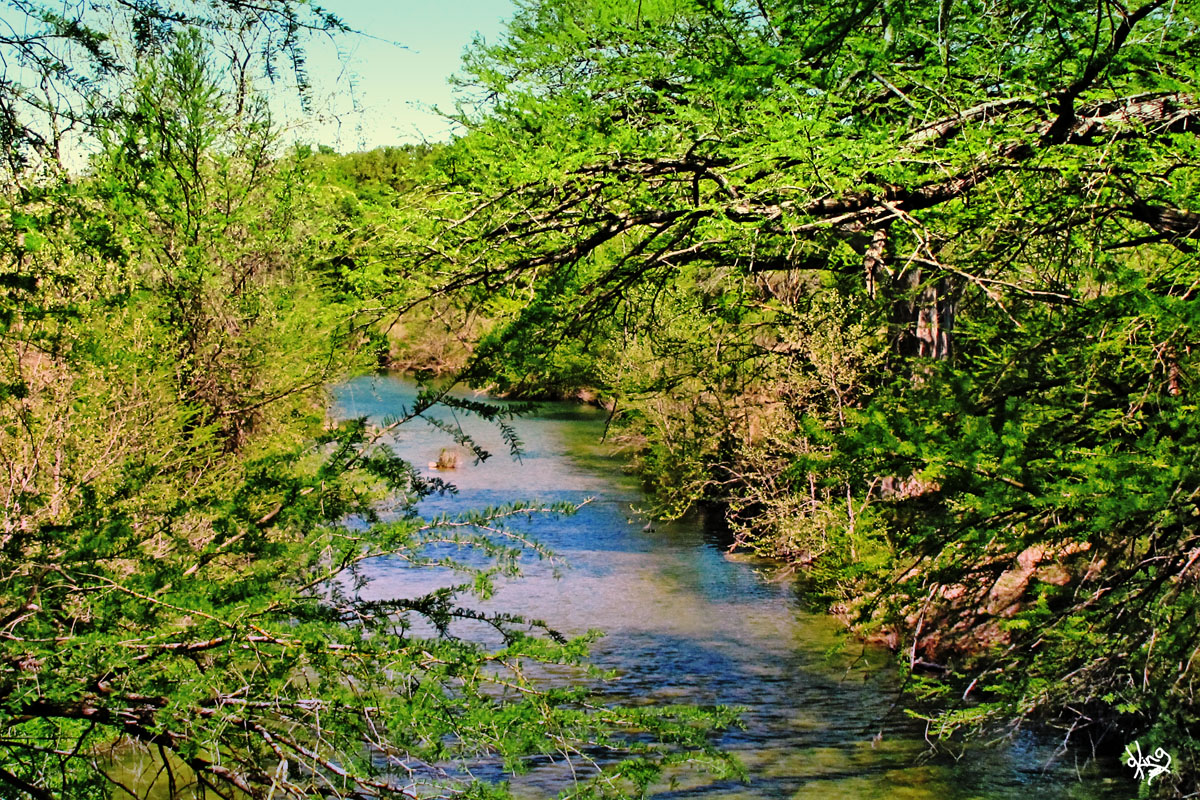
Yeager Creek along Yeager Creek Road? Nope! Just Miller Creek... What I find interesting is that you never really see Yeager Creek along Yeager Creek road. The first time you really see a creek, it's near where Yeager Creek ends (or begins?) at Miller Creek and from then on it's all Miller Creek sightings. Click on the map and you'll see what I mean. Anyway, hopefully you caught a peek of Yeager Creek when you crossed it back on 290.
Miller Creek, Blanco County - Handbook of Texas (I like that it MIGHT have been named Miller Creek because there was a MILL somewhere along the creek at one time. It must have been tough to dream that one up.)
I can't find out much about Yeager Creek EXCEPT that they do offer Yeager Creek Fettuccini on the menu at the Creek Road Cafe on 290 in Dripping Springs. Based on our dining experiences at that cafe, I bet it's delicious!
Directions: We meandered amongst the bluebonnets and creek crossings along Yeager Creek Road for almost 5 1/2 miles until it T'd on Robinson Rd (aka FM 2766).
|
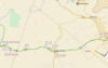
Map of Yeager Creek Road to Johnson City
Miller Creek (near where Yeager Creek meets it) Photo and Google Earth Location
|
|
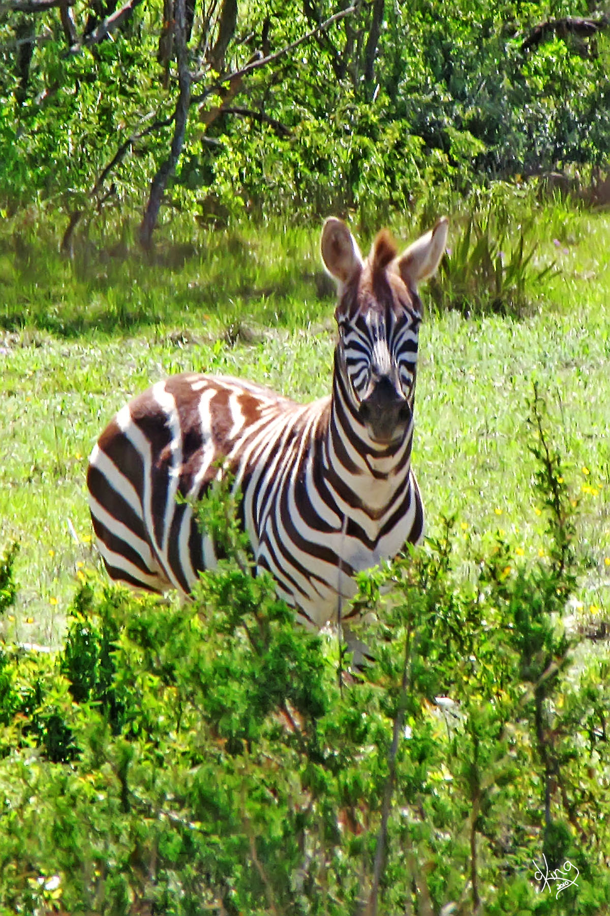
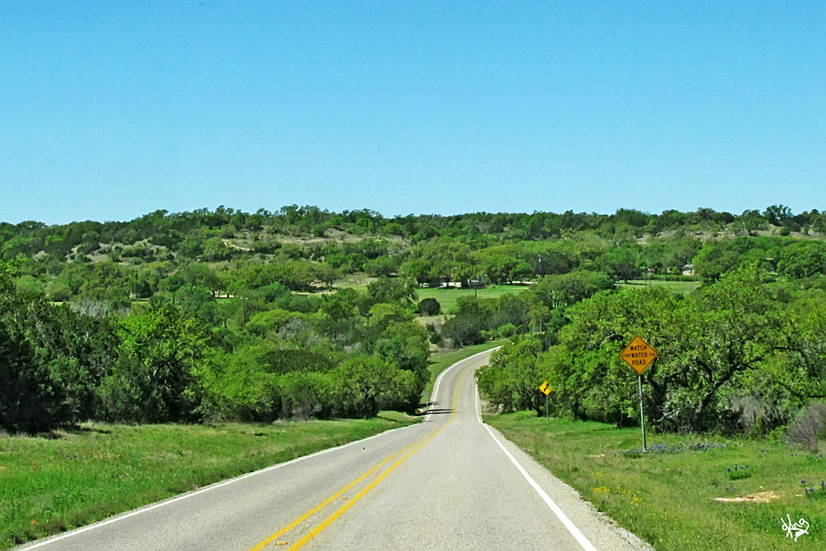
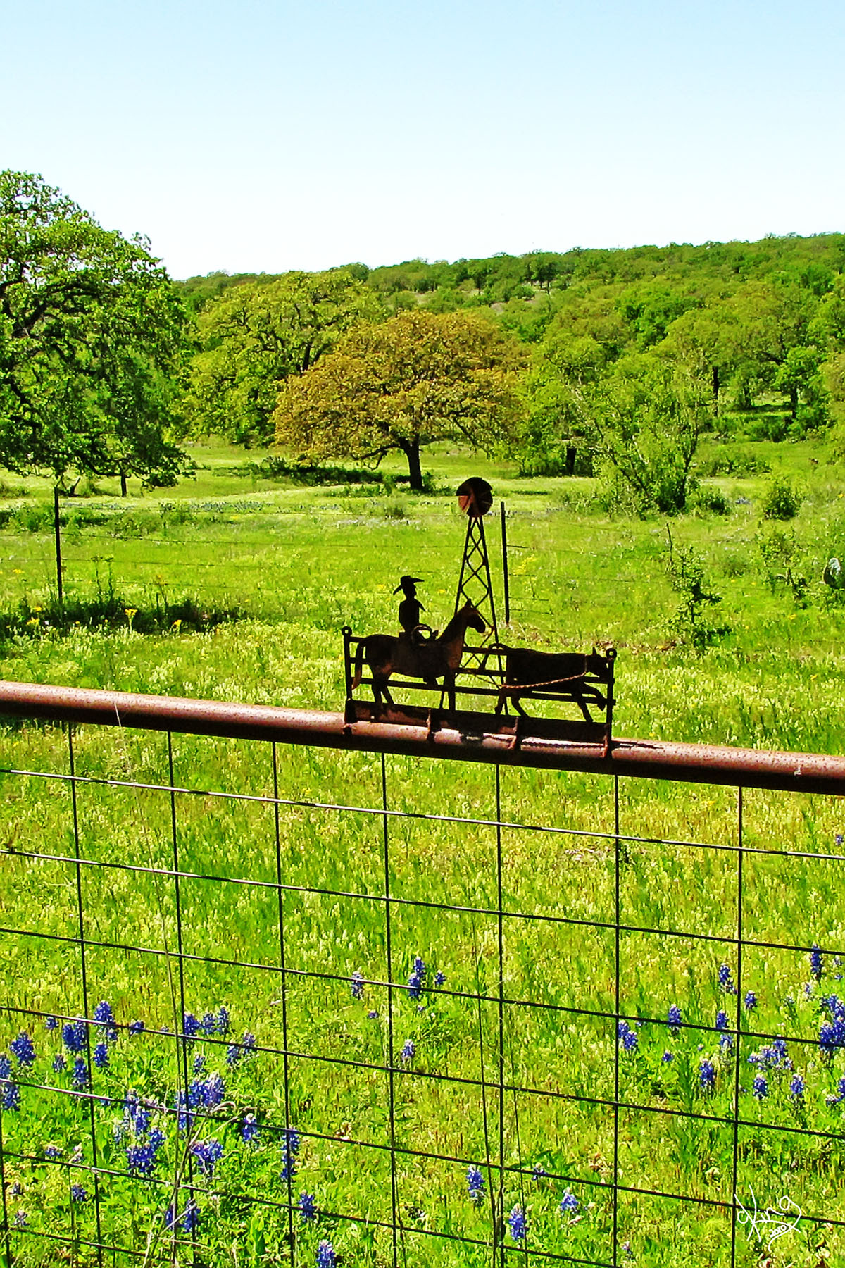
Sightings Along Yeager Creek Road If the zebras come out to say hello and make you think you're in Africa, a very Texas-y windmill will soon debunk that theory.
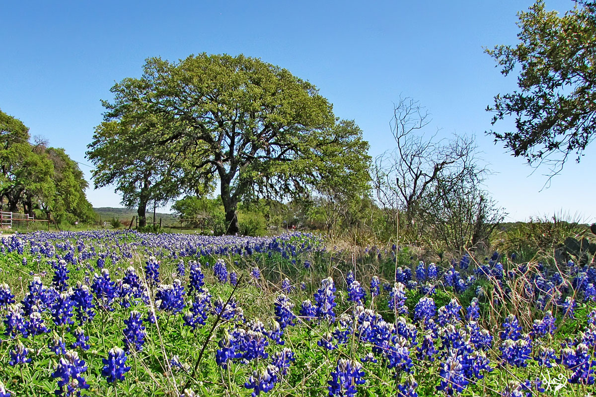
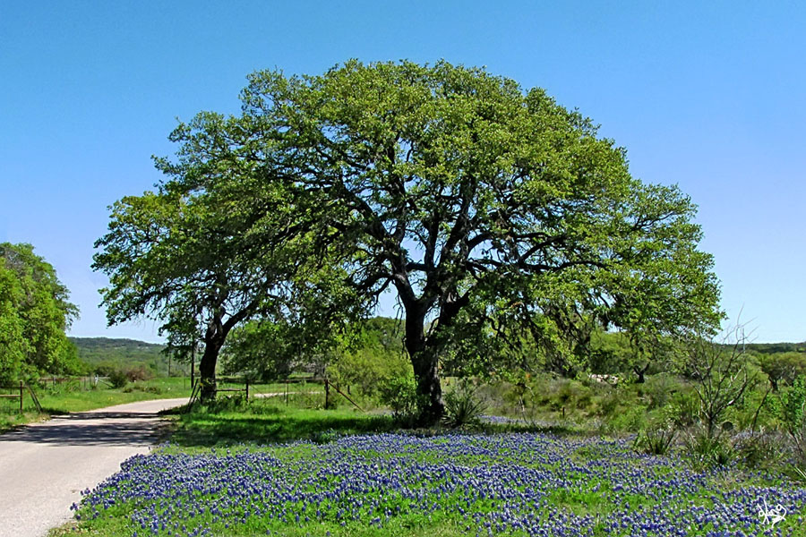
ALL RIGHT! There's the photo (down over there on the right) that seems to be famous everywhere in the Texas Hill Country. How did that happen? I just took it! You know, the one with the oak tree and the bluebonnets that shows up on so many of the motel and B&B walls.... photographed by thousands and interpreted by hundreds of artists. WHY? Well... just LOOK at it! It's pretty, pretty, pretty.
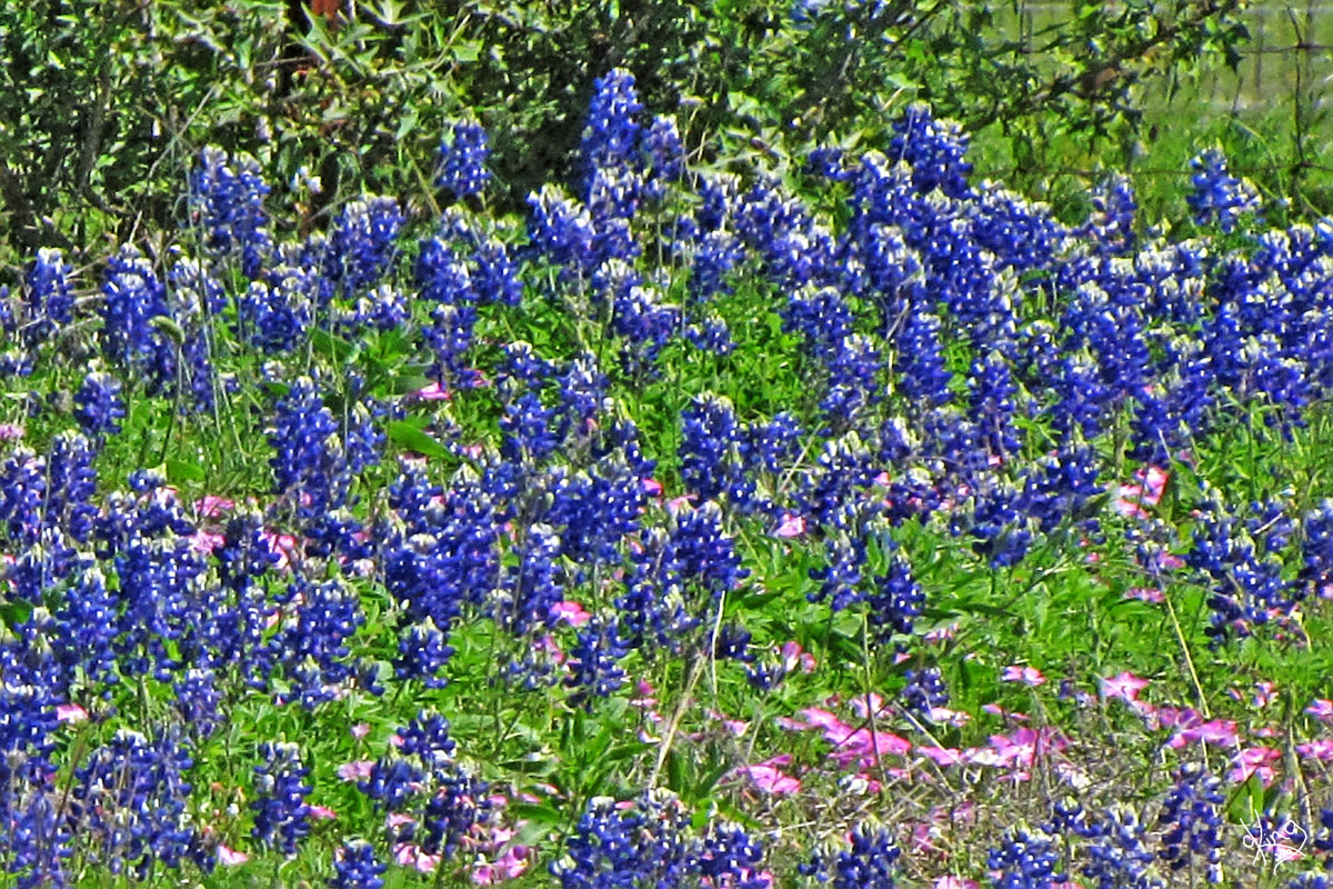
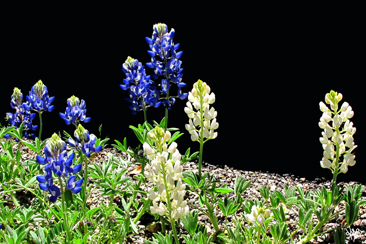
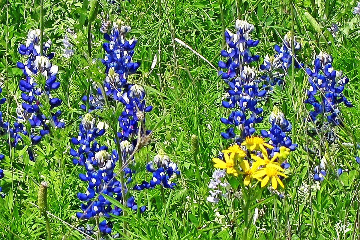
Oh, and MORE bluebonnets!
Postcard, Note Card, or Wall Prints Wall Prints
Directions: Arriving at the T at the end of Yeager Creek Road, we decided it was time to turn left onto Robinson Road, or FM 2766, and head towards Johnson City. |
Zebra NoteCard/ Postcard, Windmill NoteCard/ Postcard
Postcard, Note Card, or Wall Prints
|
|
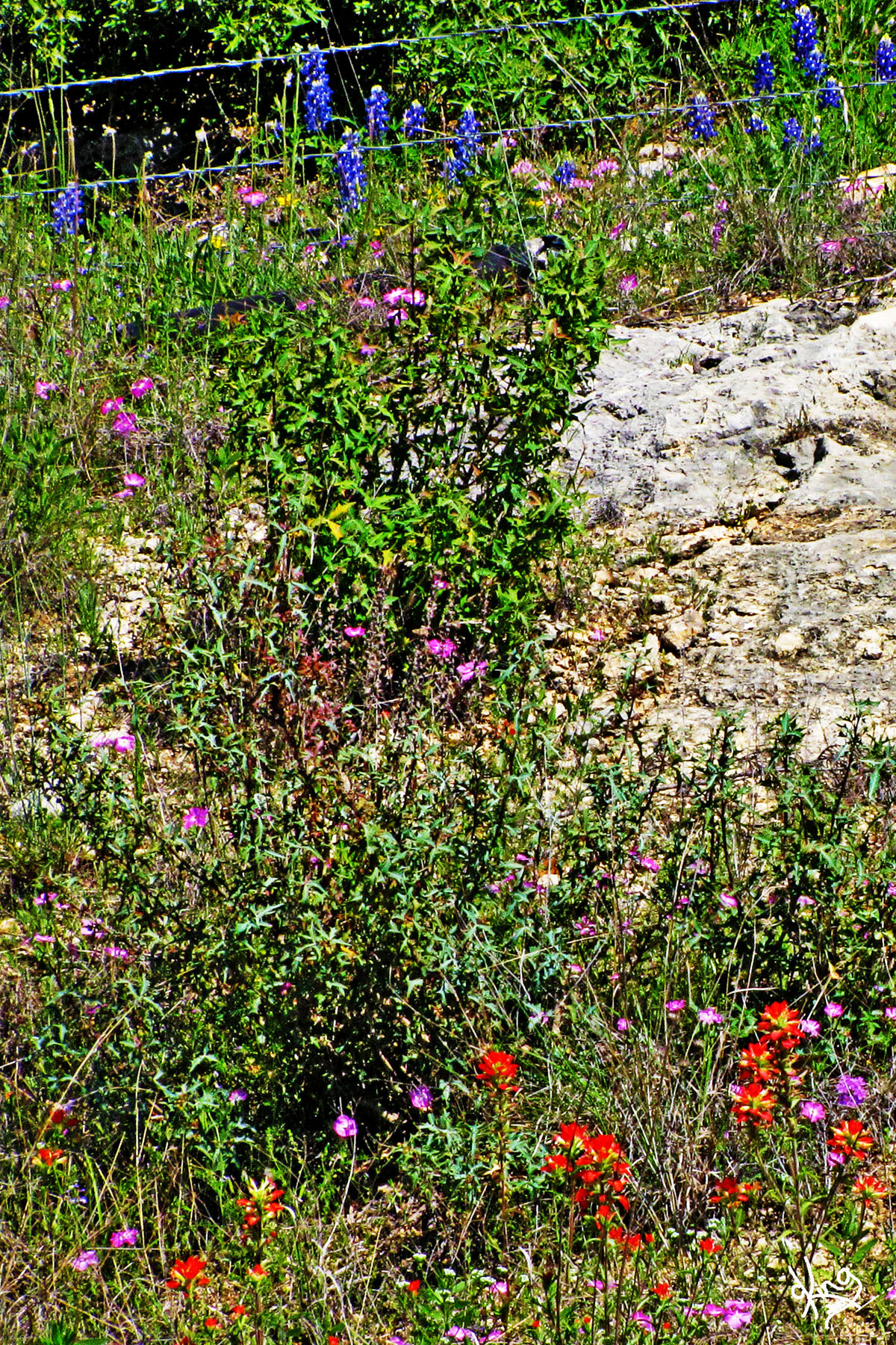
Robinson Road Treasures
Robinson Road brings "YEEEEE HAW" to mind.
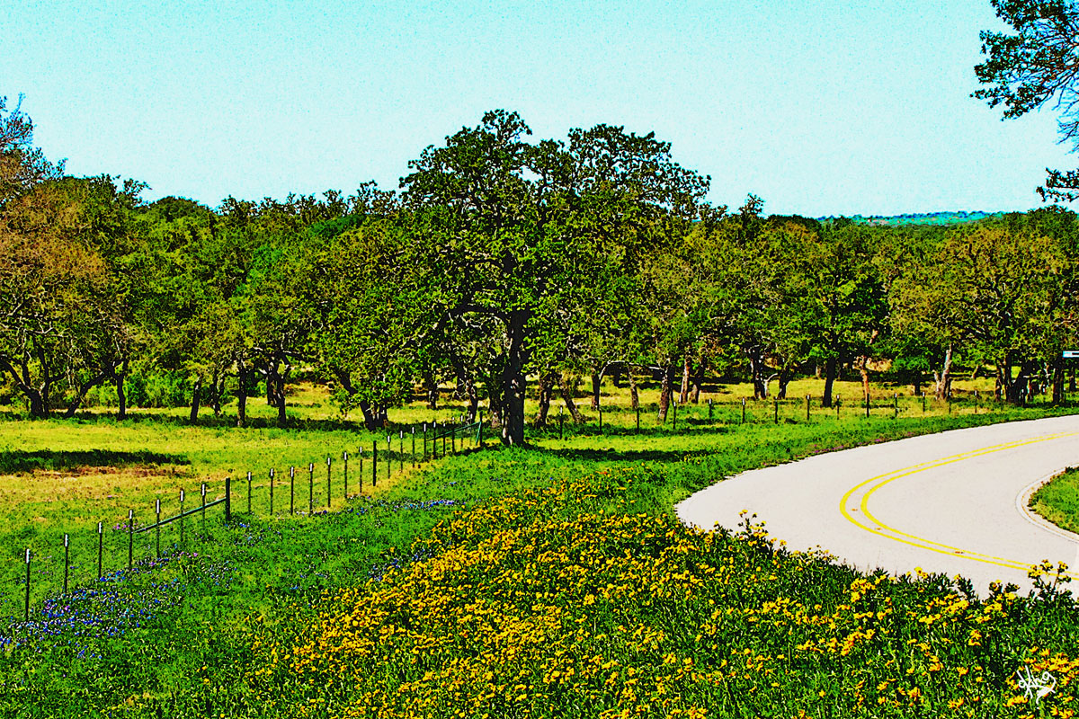
Look over there, that wildflower artiste must have found the yellow can of paint.
Crossed that long ol' Miller Creek again, and found the flowers that put the 'wild' in wildflowers...
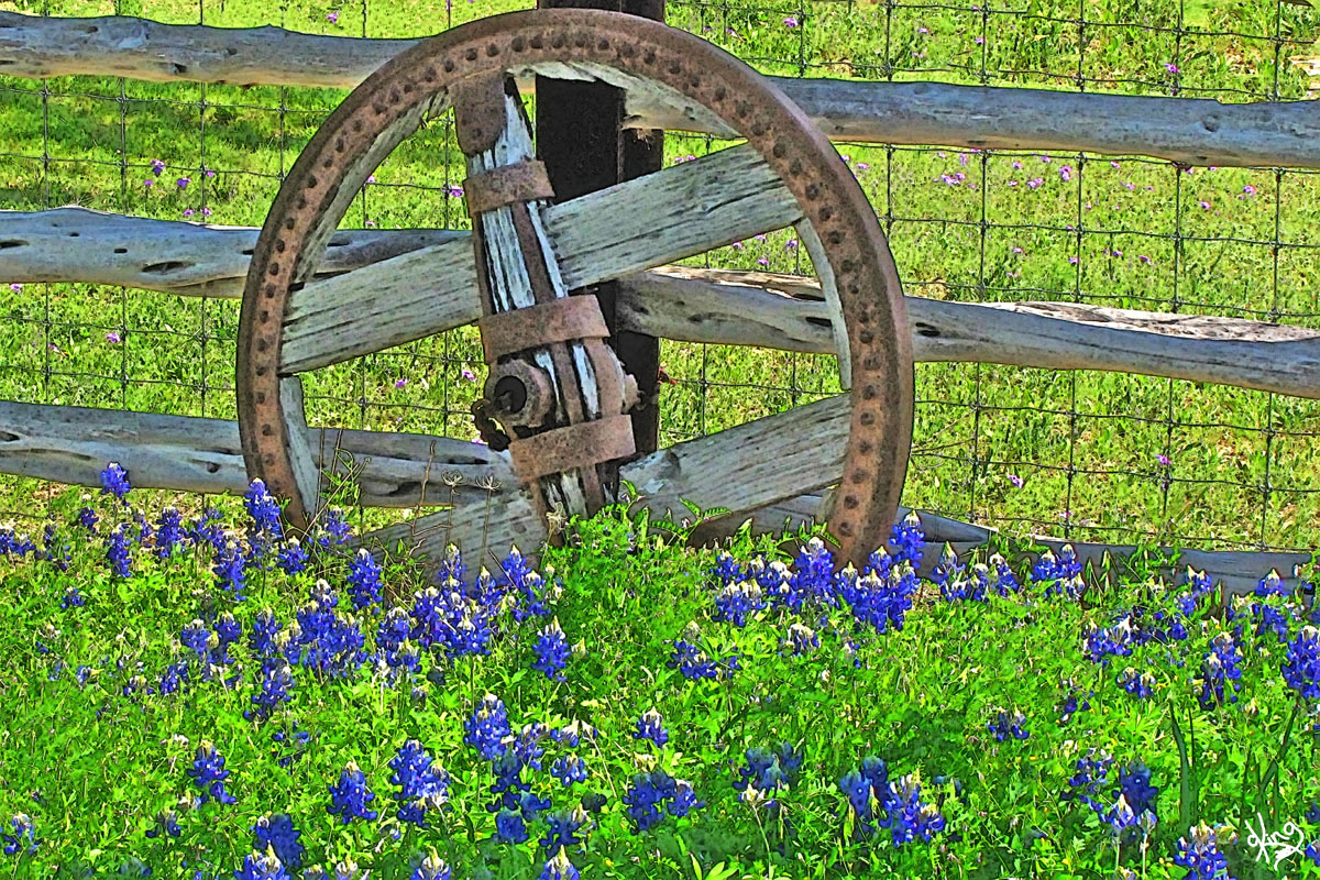
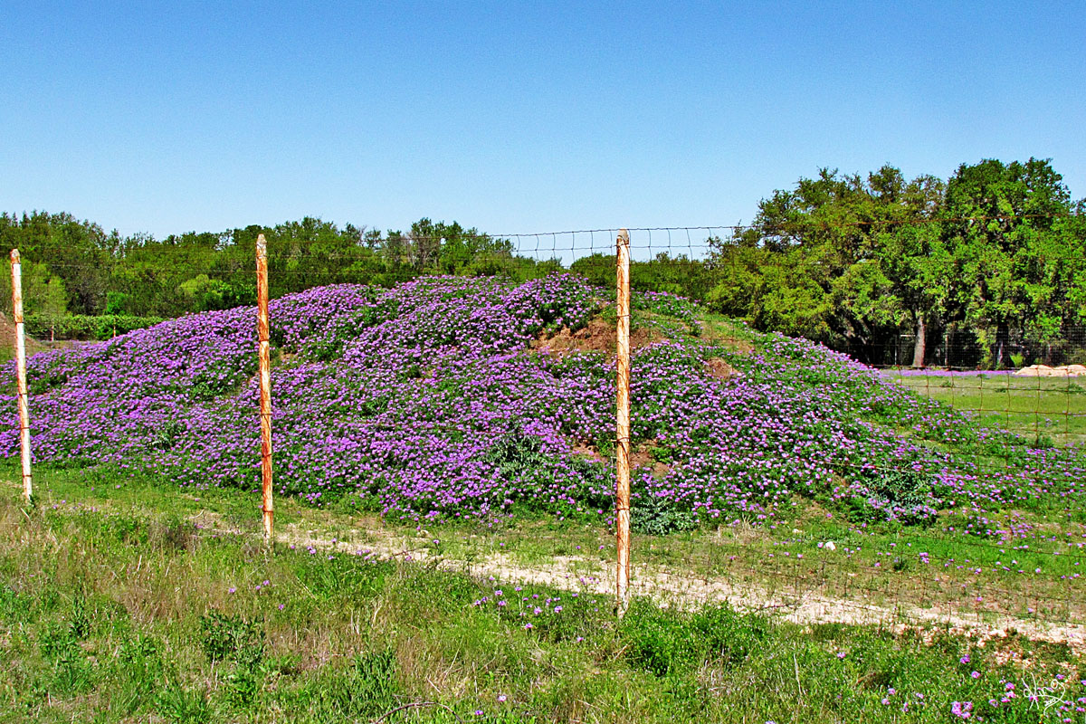
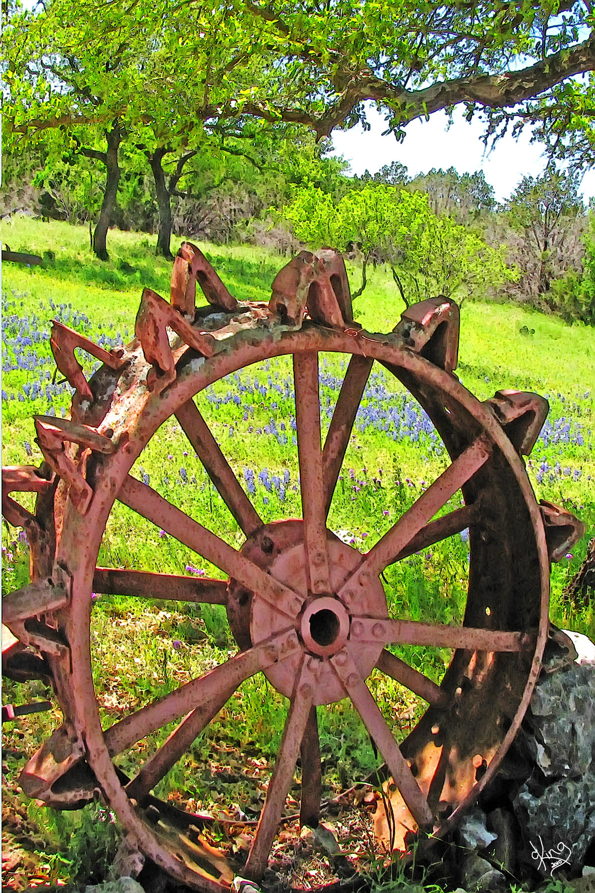
It's a good thing for the poor, out-of-work wagon wheels that bluebonnets were invented. It gives a whole new purpose to their lives. And doesn't that pile of dirt covered with purple flowers kind of make a statement about its need to be a part of the crowd?
Postcard, Note Card, or Wall Prints
The night I first saw you, Fused my heart to a star. Brushing my hat across the sky Certain now, I'll never roam far.
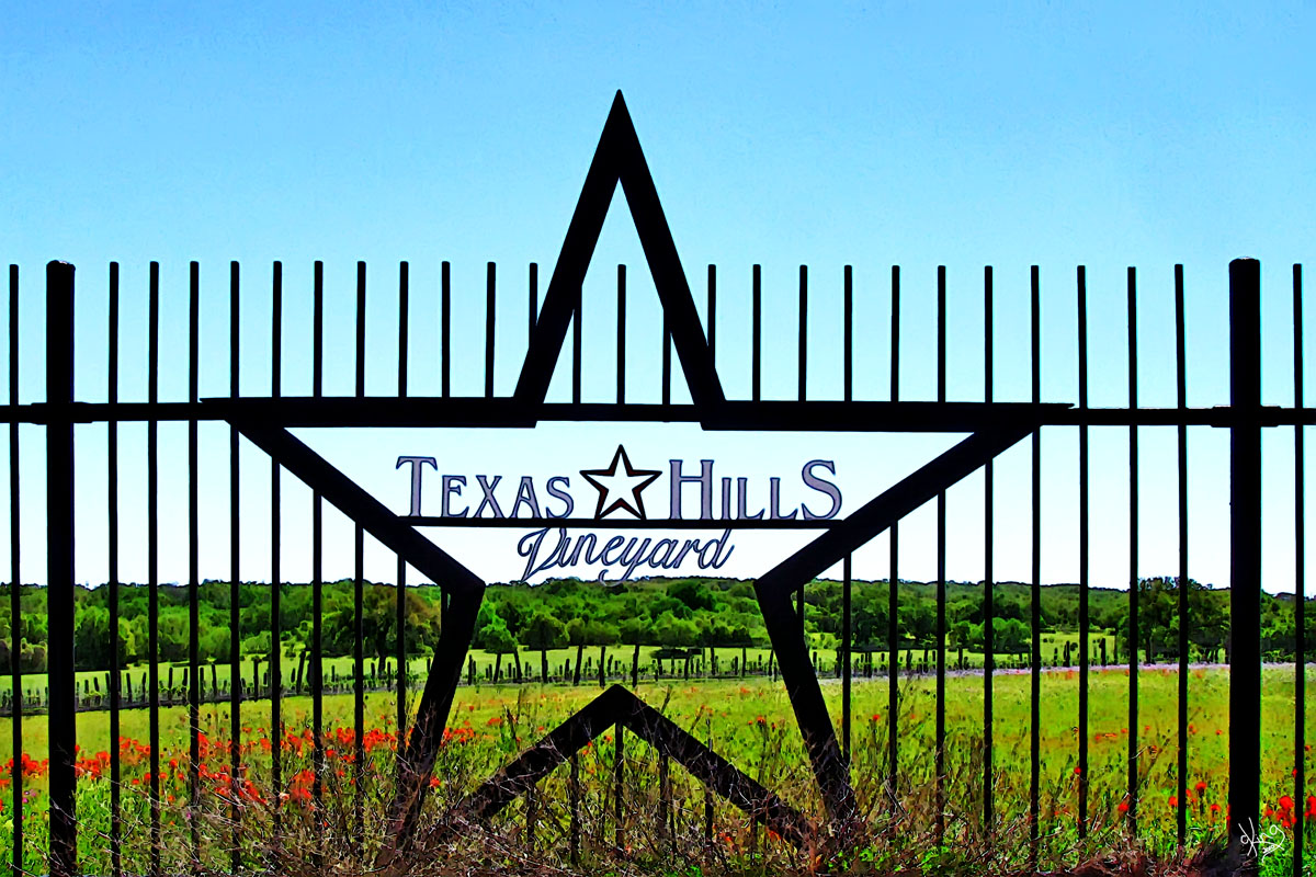
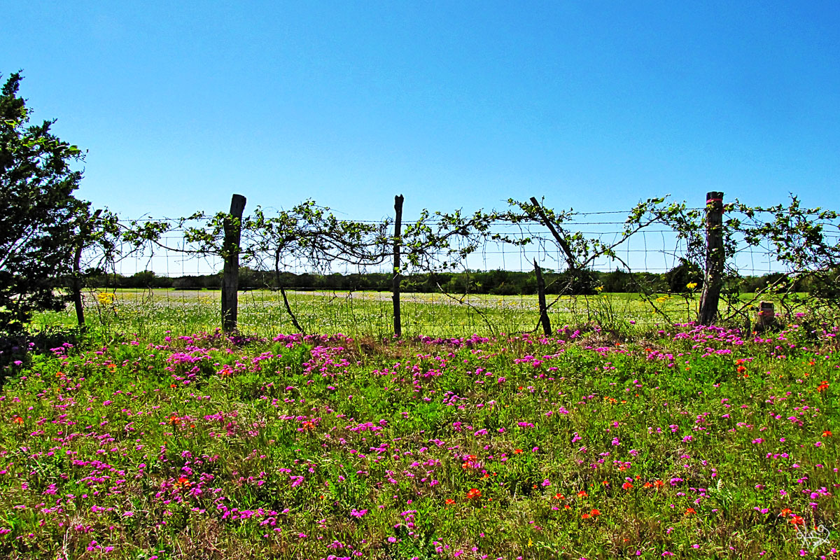
Directions: Between 6 and 7 miles after turning onto Robinson Road, we spied the Texas Hills Vineyard on our left.
|
Postcard, Note Card, or Wall Prints
|
|
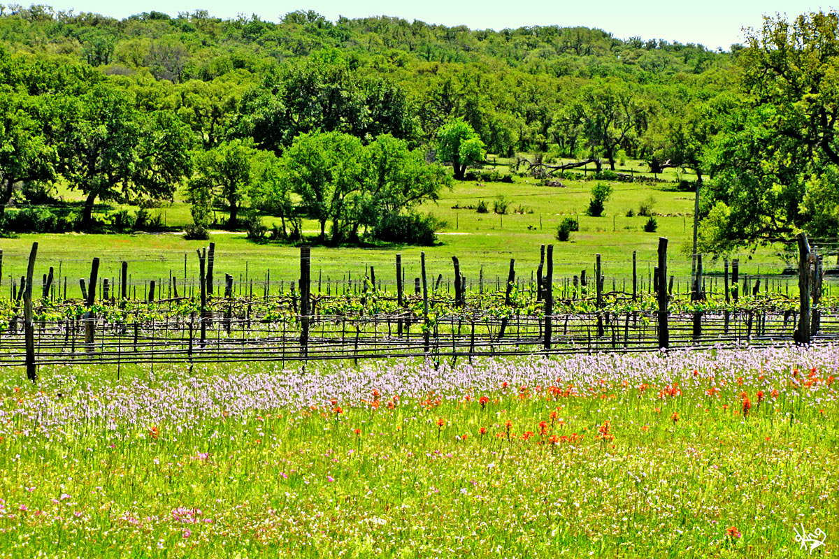
Texas Hills Vineyard I wish we could say we stopped in to try the wine, but our focus was still on the flower quest. So, we paused and shot some pix of those healthy looking grape vines and gate and made a note to come back and wet our taste buds SOON! BTW, the Texas hill country is rich in vineyards and wineries. Maps to them are available all over the place, but remember!.... designated driver..... :)
From their web site: Texas Hills Vineyard "Texas Hills Vineyard is located in the gentle hills of the picturesque Pedernales River Valley in the Texas Hill Country near Johnson City. A perfect location for growing quality grapes, the intense Texas sun by day and the cooler hill country nights gives our grapes an intense and quality flavor, ideal for wines. Texas grown grapes for Texas Wine"
I should also mention that right by the vineyard is a road sign that says "Heart of Texas Wildlife Trail East, Site Hote-051". Click the link to see what that's all about.
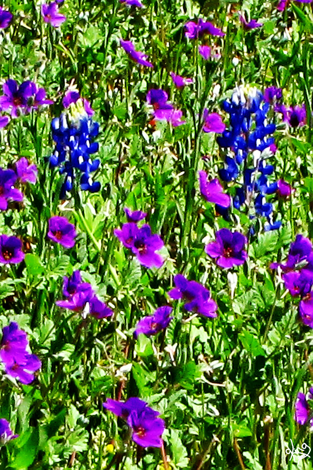
I thought it was very coordinated that the bluebonnets by their fence were surrounded by purple flowers. Sort of goes with the whole grape theme....
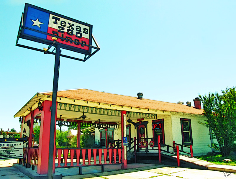
Directions: Continuing west on Robinson Road for a little over a mile from the vineyards, we arrived at Hwy 281 in Johnson City. Since we don't like main roads, we went across 281 and angled our way north where we found the Texas 290 Diner at 300 E. Main Street. We were HUNGRY, so we stopped there.
|
|
|
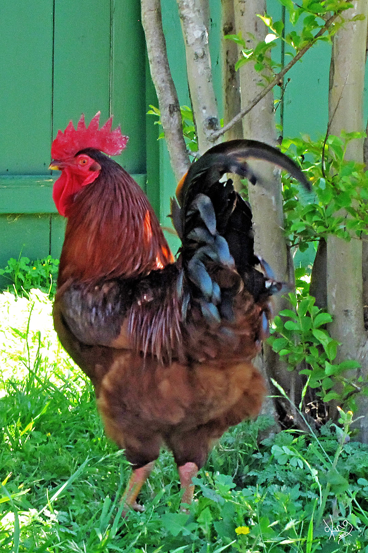
Texas 290 Diner, Johnson City, TX. I am a pushover for fried pickles, so it didn't take me long to spy and scarf some down! JR and I split a patty melt which lived up its name nicely. Had a chuckle with the waitress as she wrote our order on the palm of her hand. Seeing the rooster outside and on the menu, I had a corny thought about the 'chicken fried steak' on the menu.... Get it? I guess the rooster chef was taking a break when we saw him....
Postcard, Note Card, or Wall Prints
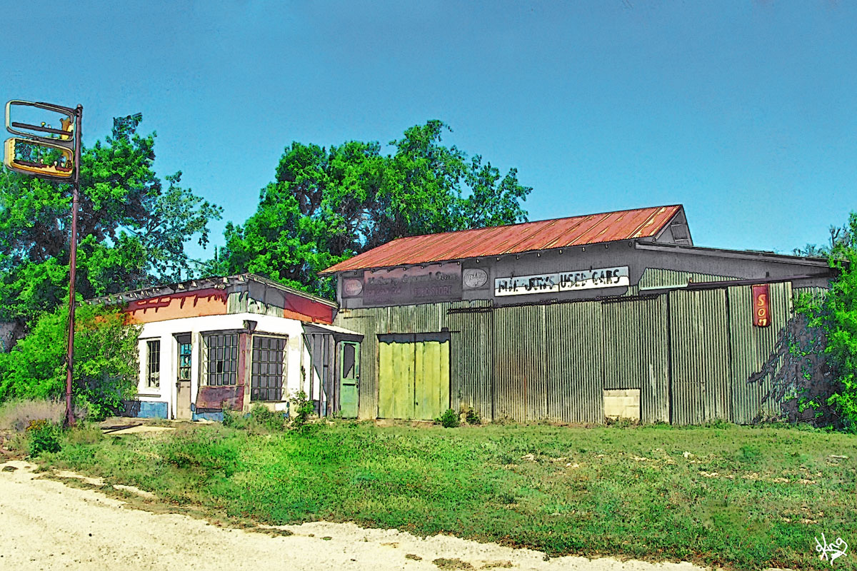
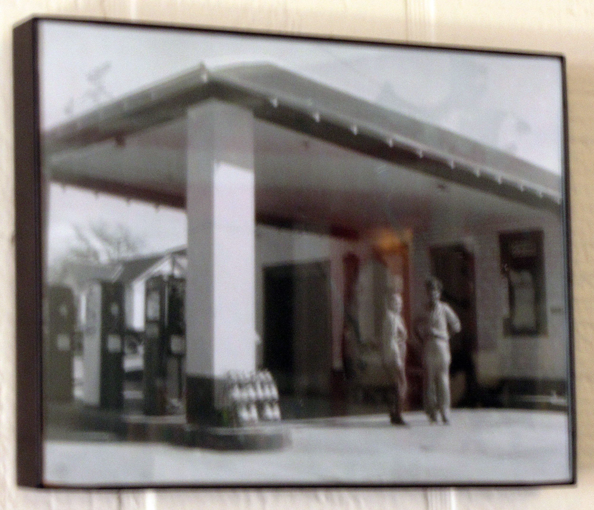
Always fascinated by the recycling of old filling stations, I was glad to see the photograph of this place in its former life that was hanging on their wall:
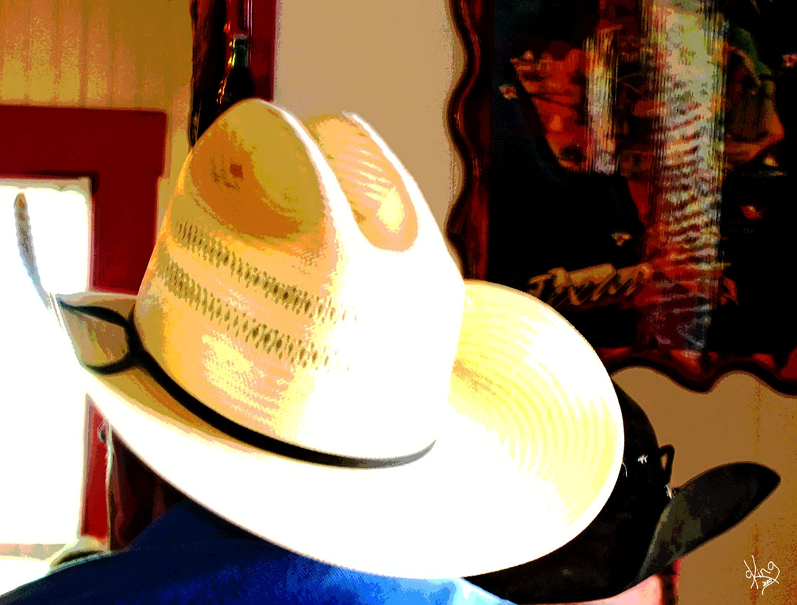
Small town Texas cafes always make me want to capture their flavor.... Generally there's a sea of cowboy hats..... Good guy? Bad guy?
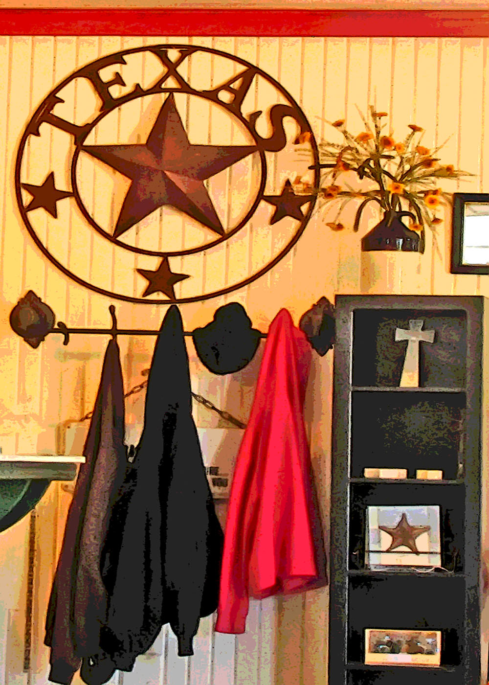
And it's always inspiring to see how those diners support their local artisans..
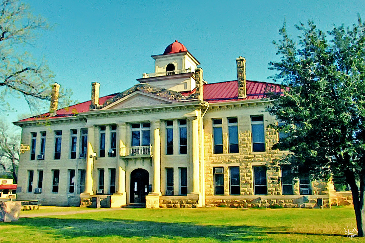
Directions: After filling up, took a sec to gander at the Blanco County Courthouse on the other side of 290. The 'town square' with the courthouse is just a block north and easy to find.
|
Postcard, Note Card, or Wall Prints
Postcard, Note Card, or Wall Prints
|
|
Blanco County Courthouse, Johnson City, TX Just had to post the courthouse pic with a little info about the town before getting back to our bluebonnet mission....
Johnson City, TX - Handbook of Texas
Blanco County Courthouse scoop from Tx Historical Comm
|
Postcard, Note Card, or Wall Prints Photo and Google Earth Location
|
|
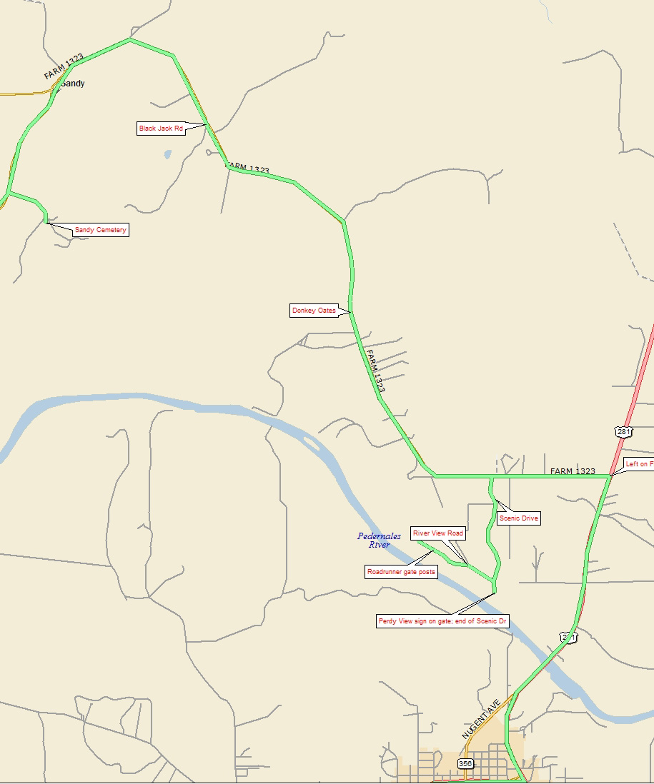
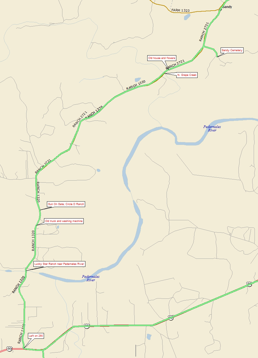
Map - Johnson City to Sandy So... to see what happens next, click the map icon to the right!
Directions: On out of Johnson City to the back roads again. From the courthouse, we went back to 290 (or Main St.) and turned left to go back to Hwy 281. At Hwy 281, took a left and headed north for just under 3 miles and turned left on FM 1323. We traveled on 1323 for a little under a mile and spotted the street sign for 'Scenic Drive' where there was a Pedernales subdivision type of sign. Just had to turn left there to see the 'scenic'! When we reached the dead end of Scenic Drive, we turned around and soon found River View Drive and took a left on it to explore until it also reached a dead end. (We never saw the river....) See map of next leg at right. |
Map of Johnson City to Sandy |
|
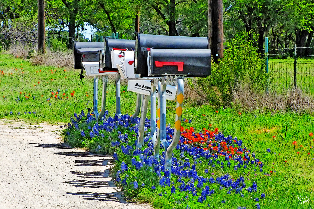
The 'Scenic' of Scenic Drive (AND River View Drive) As anyone who has traveled the back roads with me will tell you, I have a thing for mailboxes. So many times they display the creativity of their owners. This trip didn't provide any of those, so I just decided these were creative all on their own!
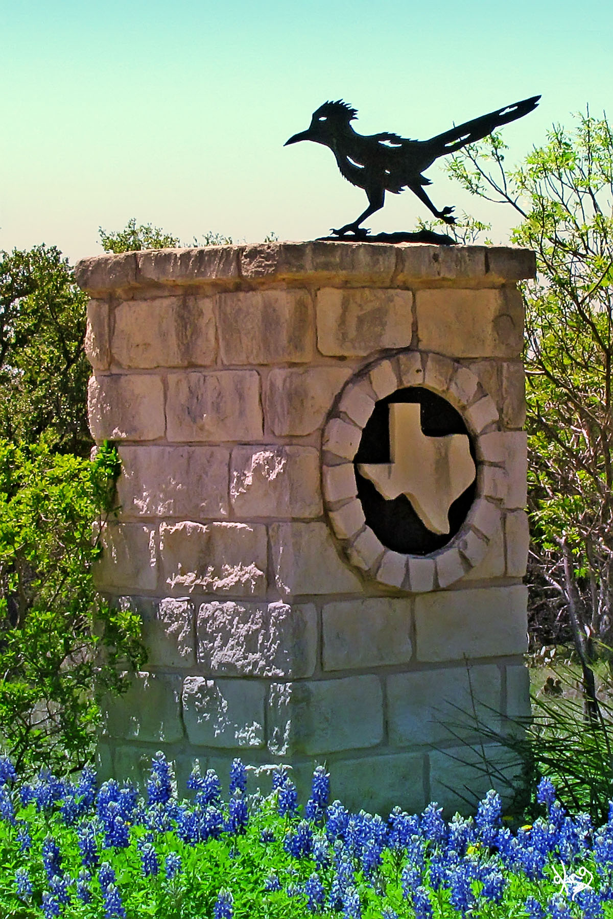
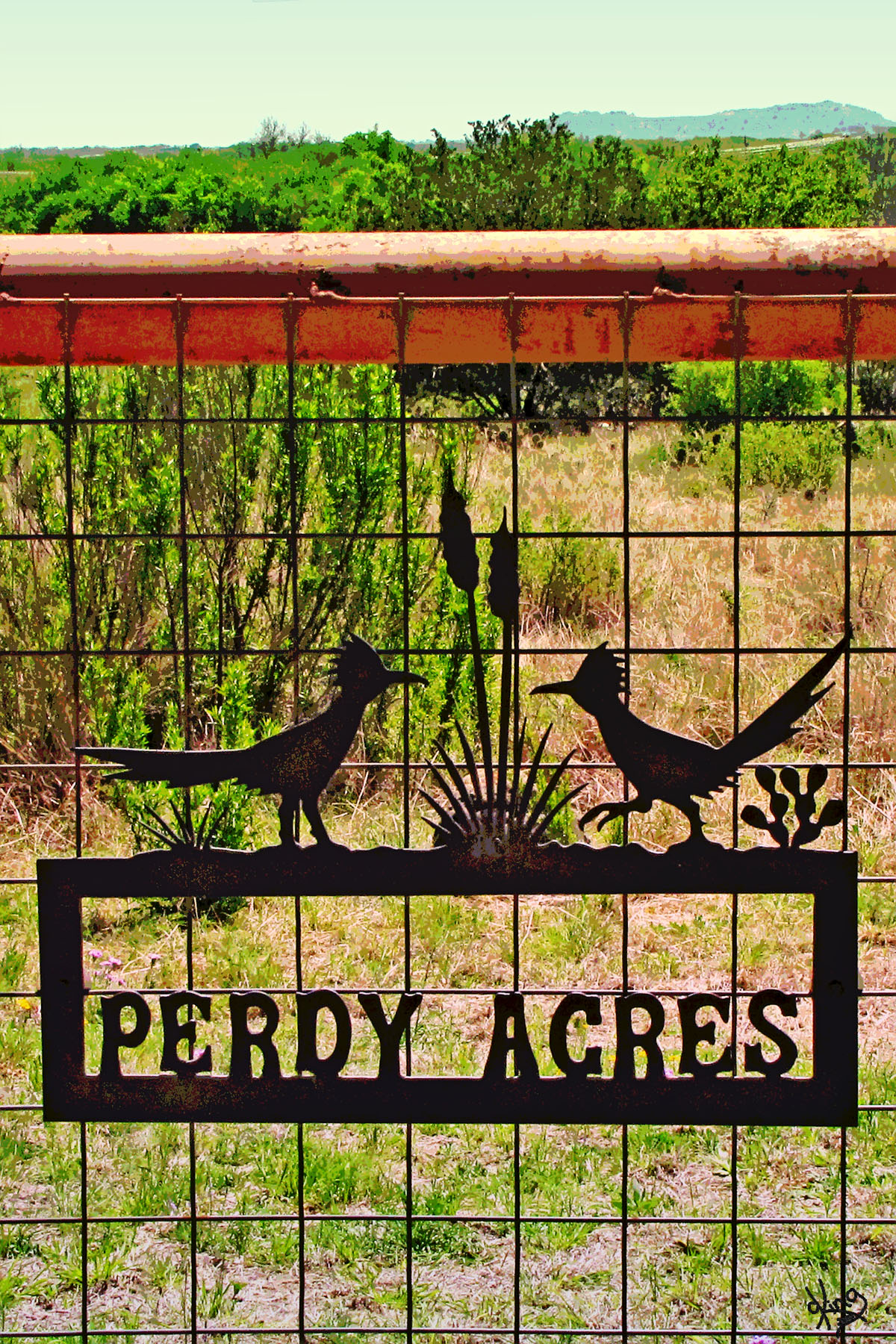
Dead end on Scenic Drive, but it DID have some 'Perdy Acres'. Oh yeah, check out the roadrunner theme they've got goin' on in this neighborhood!
OKAY, OKAY, we won't steal your roadrunners.....
River View Road
Postcard, Notecard, or Wall Prints
Directions: After the 'scenic' prowl, we found our way back to FM 1323 and turned left and headed towards Sandy, TX (which we found in a little over 5 miles). More interesting stuff to behold, though, before arriving in Sandy....
|
Postcard, Notecard, or Wall Prints
|
|
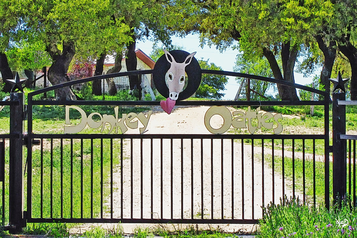
On the way to Sandy on FM 1323 Very cool donkey play on words, don't you think? Johnson City Record Courier article about them at a show
Well, apparently I'm not the only one who thinks Cedar fever is not fun! :)
Directions: After taking advantage of photo opps during the 5 miles on FM 1323 from Scenic Drive, we arrive in Sandy, Texas! |
|
|
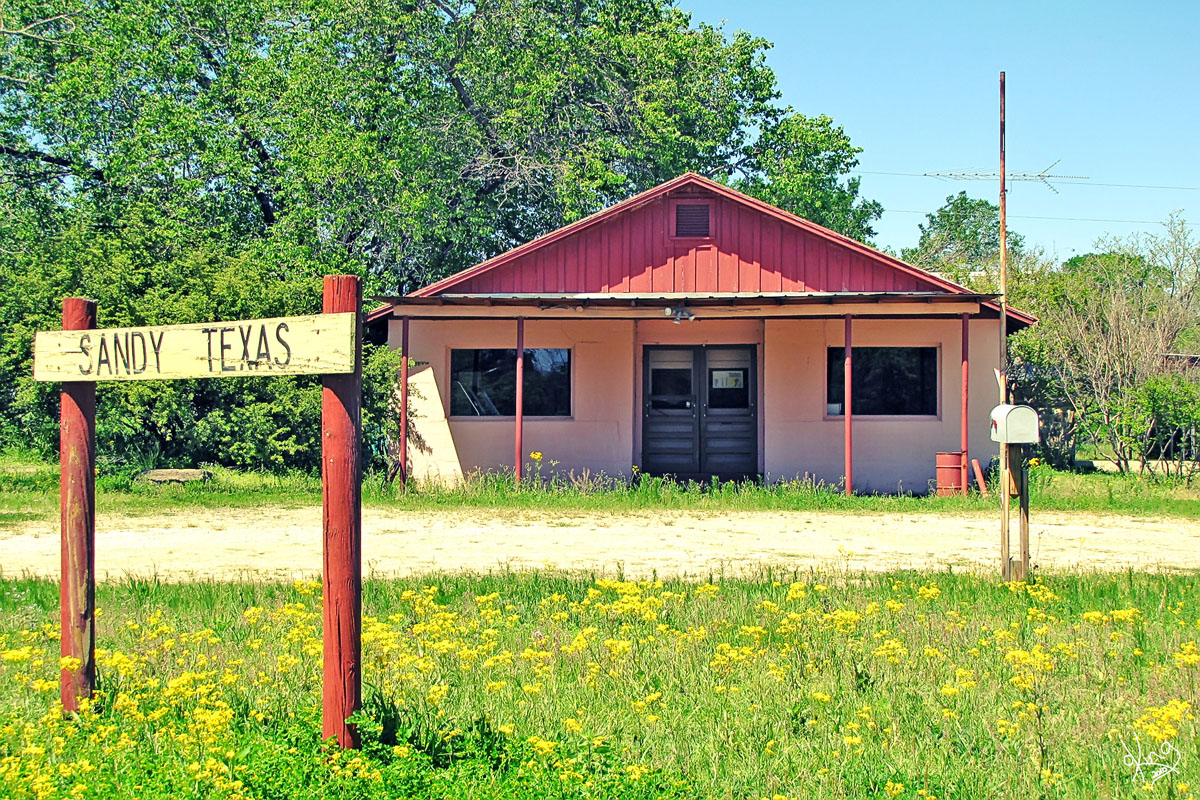
Sandy, Texas Per Handbook of Texas: "In the mid-nineteenth century settlers moved to Sandy from the Deep South, drawn to the area by the abundant water and fertile, sandy soil." Note the word 'sandy'...
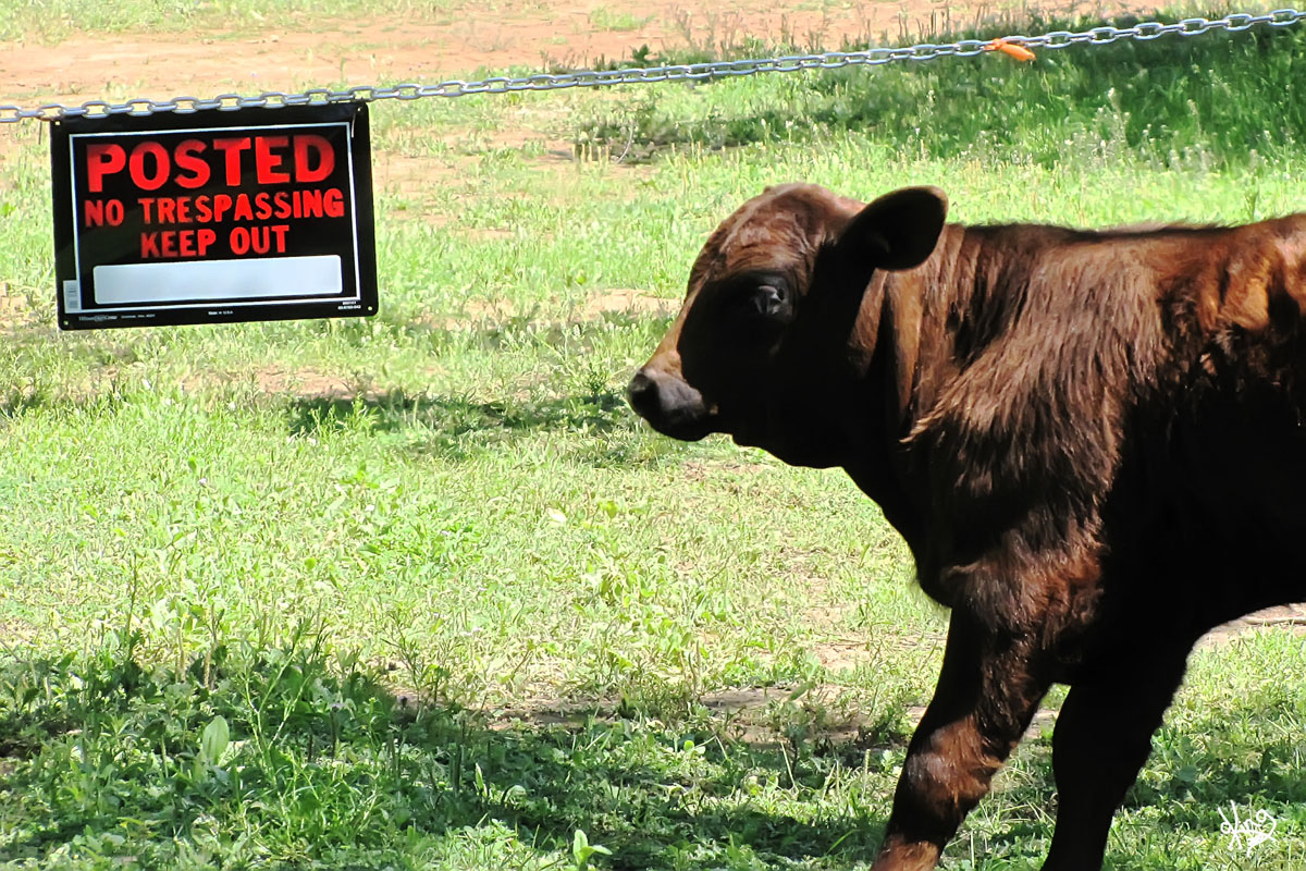
Seeing all there was left of Sandy, we decided to go see 'old Sandy' and visit their cemetery. On the way, I was amused by this calf beside a No Trespassing sign .... Don't EVEN think about it, young man!
Directions: Sandy is at the crossroads of FM 1323 and FM 2721 (Ranch 1320 on Google Maps). Take FM 2721 (RR 1320) south and Sandy Cemetery Road will be on your left in less than a mile.
|
Photo and Google Earth Location
|
|
Map of Route from Sandy, TX back to Hwy 290 Next leg of trip is on the map to the right.
Directions: Sandy is at the crossroads of FM 1323 and FM 2721 (Ranch Rd 1320 on Google Maps). Take FM 2721 south and Sandy Cemetery Road will be on your left in less than a mile.
|
Click map for route from Sandy back to Hwy 290. |
|
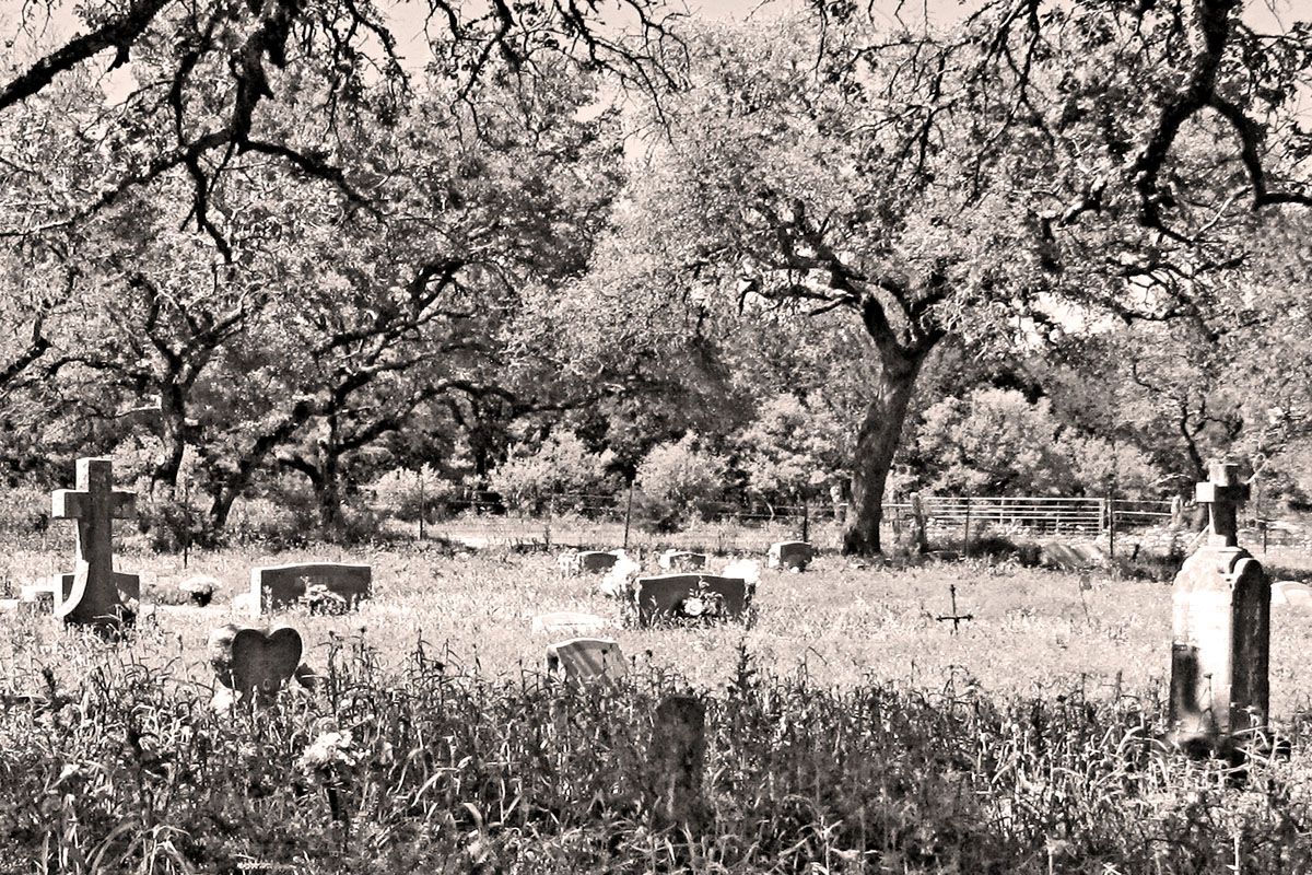
Sandy Cemetery Besides spending time thinking about the people that are buried in cemeteries, I, of course, look for the art to be found there....
From one of the grave stones: "She was too good, Too gentle and fair, To dwell in this cold world of care."
Sandy Cemetery - USGenWeb Archives
Directions: From the cemetery, head back to FM 2721 (Ranch Rd 1320) and turn left. Travel the 9-10 miles south to Hwy 290. Watch for the good stuff below on the way...
|
Sandy Cemetery Photo and Google Earth Location
|
|
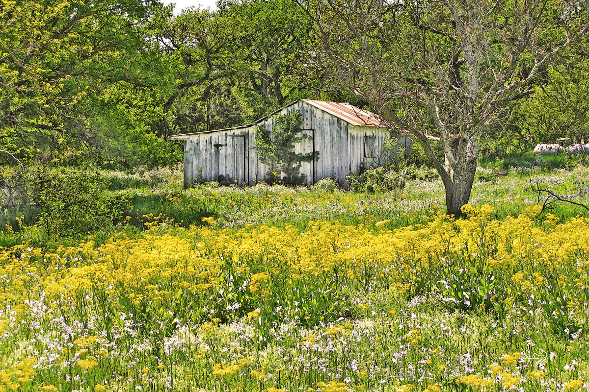
Treasures Found on FM 2721 (or is it RR 1320?)
Cross North Grape Creek.. and then spy grapevines... go figure...
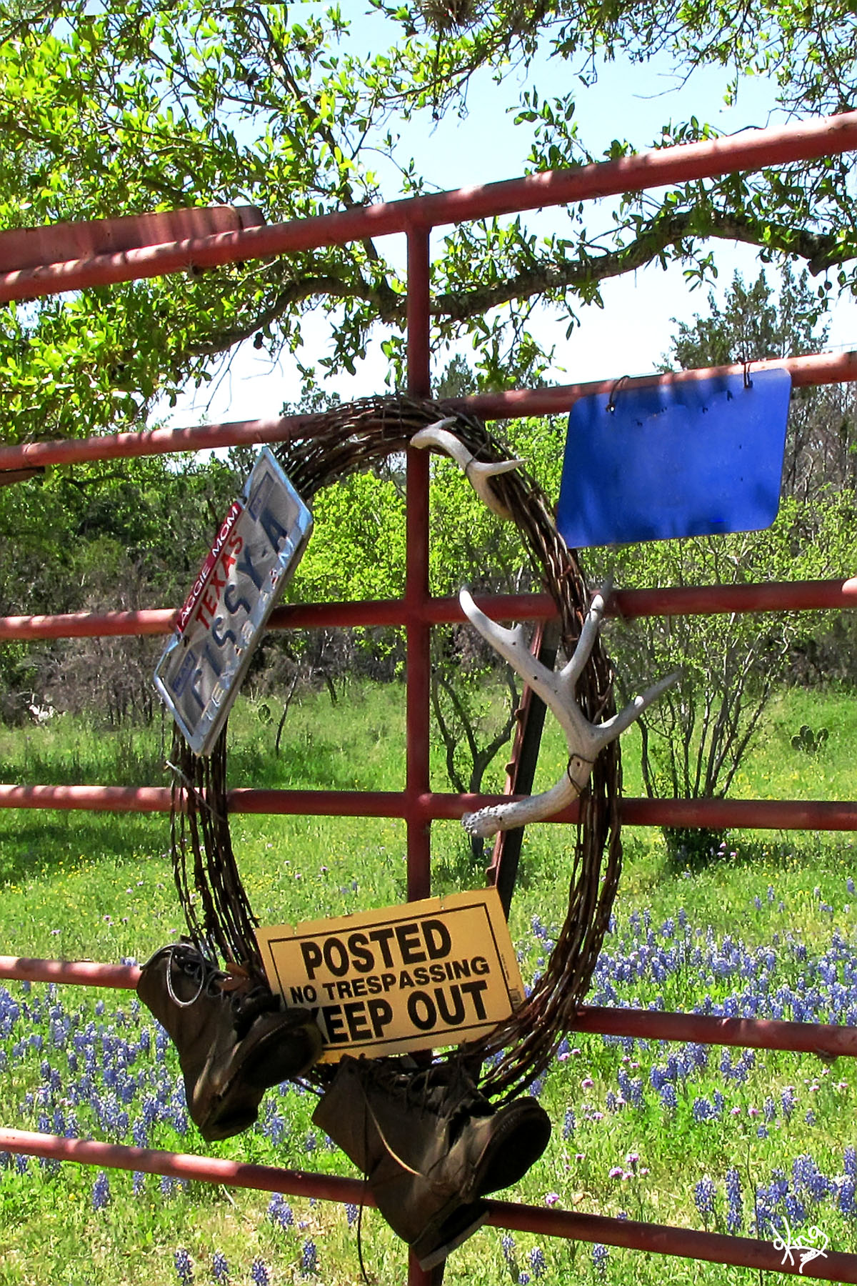
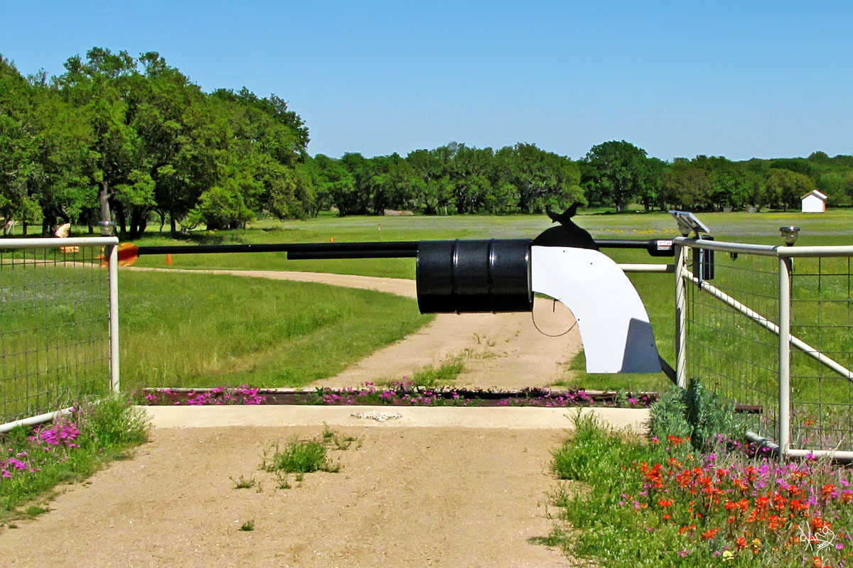
We were so busy looking at the grape vines and flowers on the right that we almost missed that gun gate. I shouted WAIT! and good driver Jimmie turned around. (He's so good about that. Trained him well.) Now, THIS was different... using a barrel for the gun barrel.. clever, clever. BTW, Did you know that people who make barrels are called coopers?
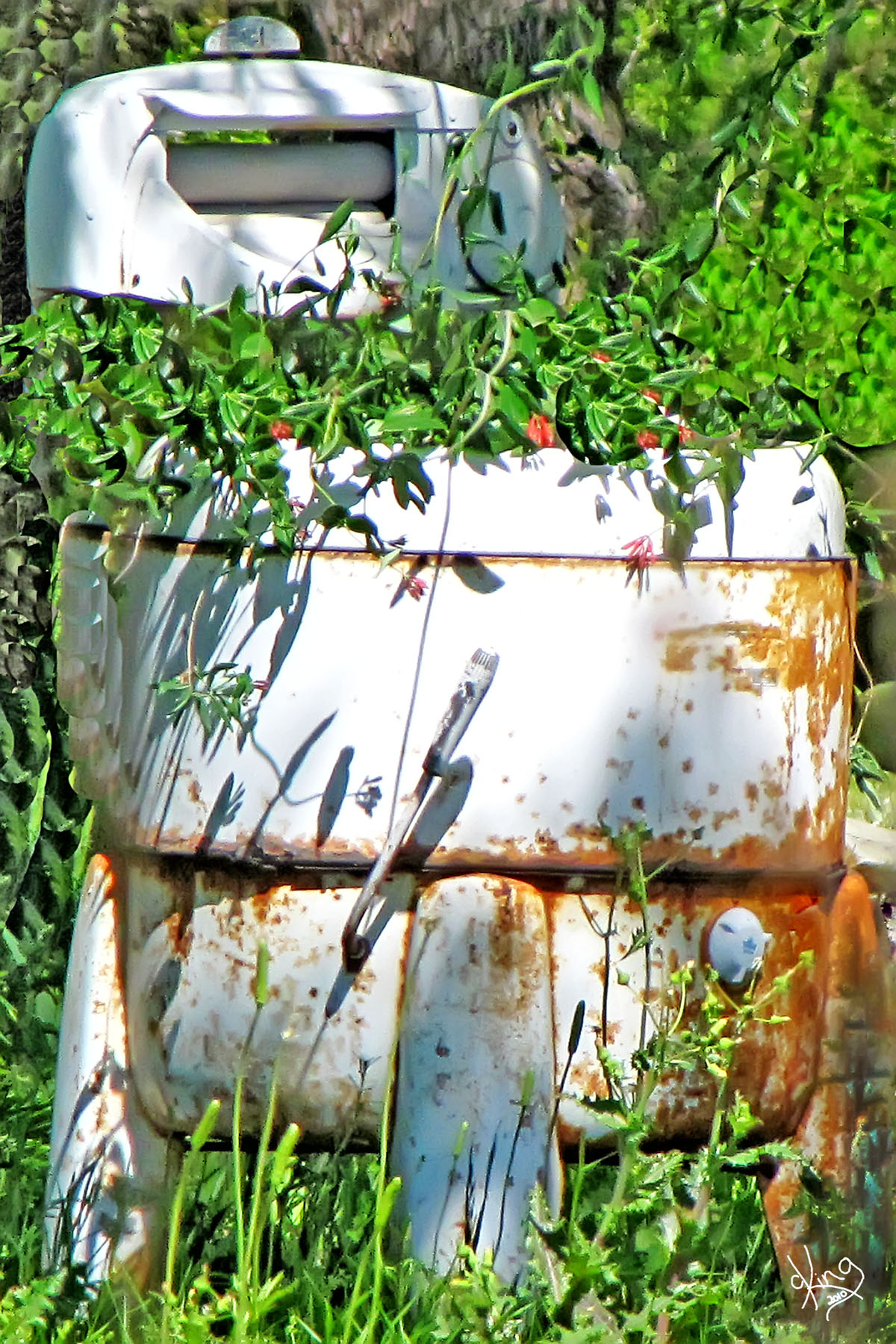
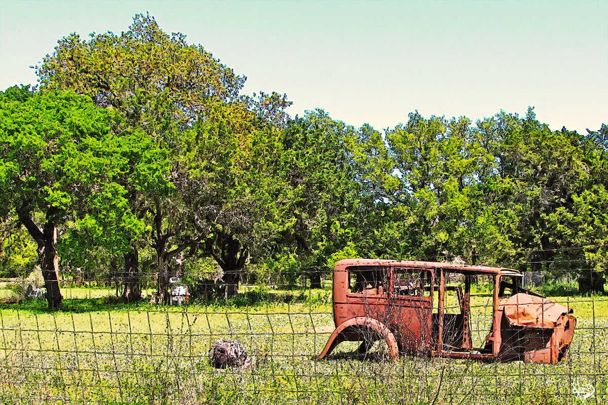
Back roads decorating ideas... Take an old rusted classic car, place in field near front fence. Turn the old washing machine into a planter and voila! You are ready for Back Roads Home and Gardens.
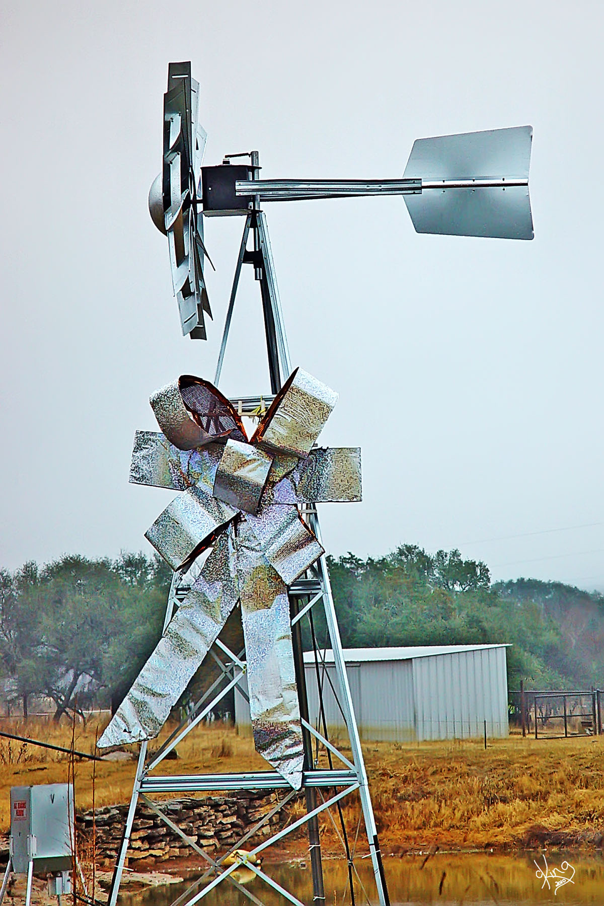
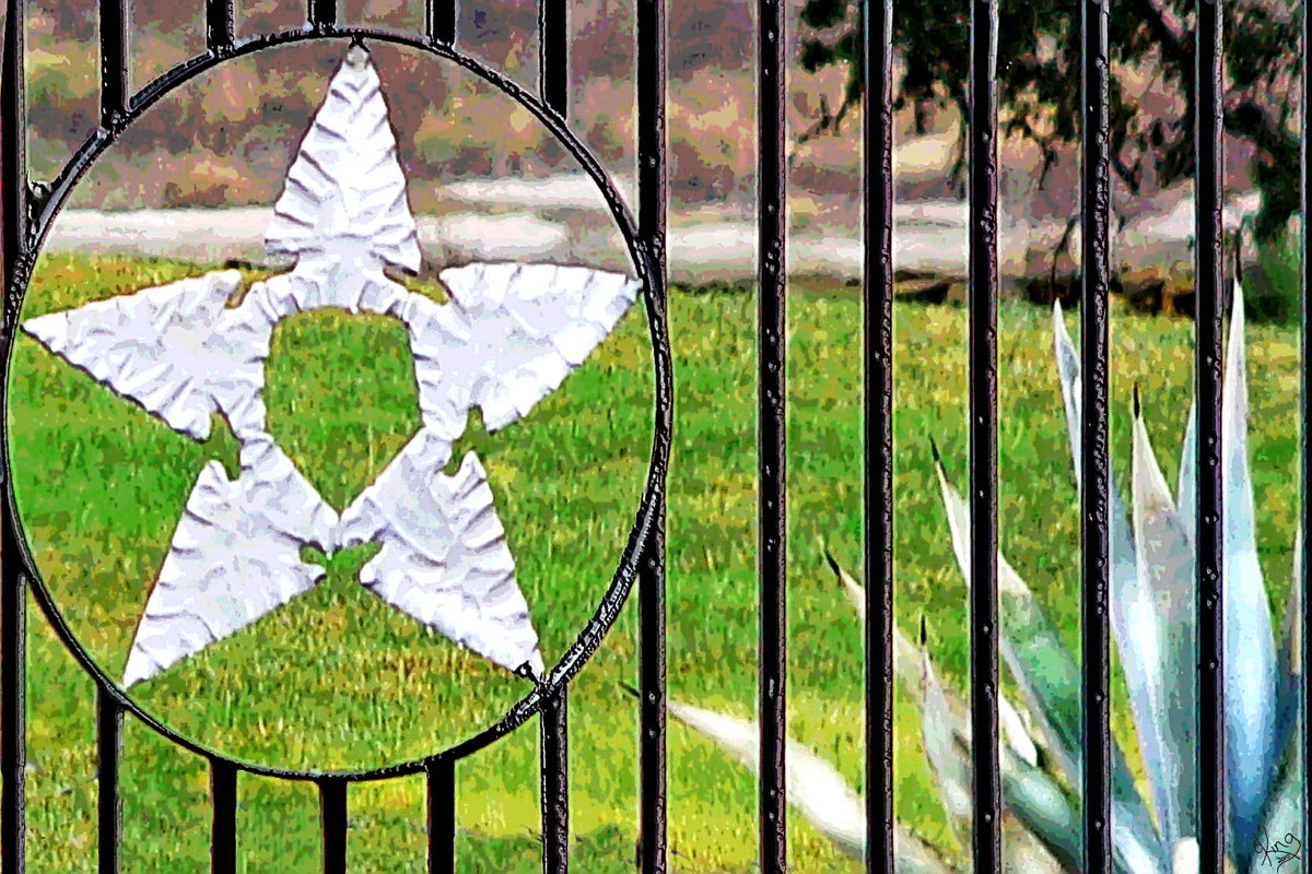
We traveled this road in 2008 around Christmas time so you won't see this now, but I had to share this great windmill gift wrapping idea with you. This was at the Lucky Star Ranch then, but I'm assuming has since been unwrapped. (That's their lucky star over there on the gate I guess.)
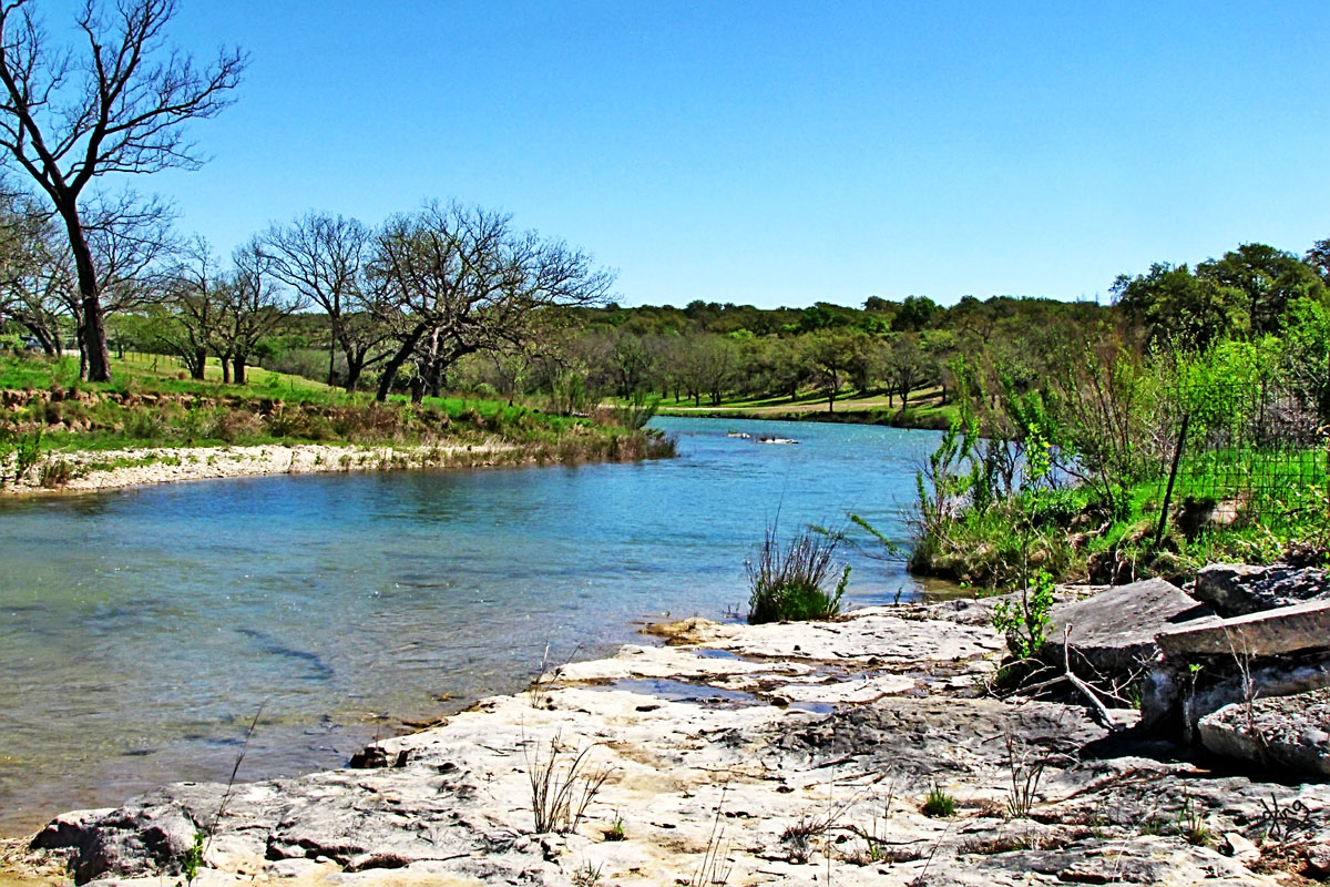
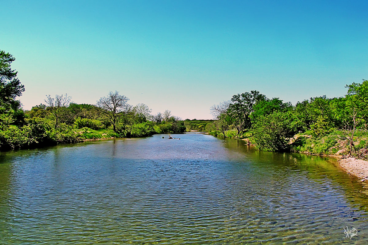
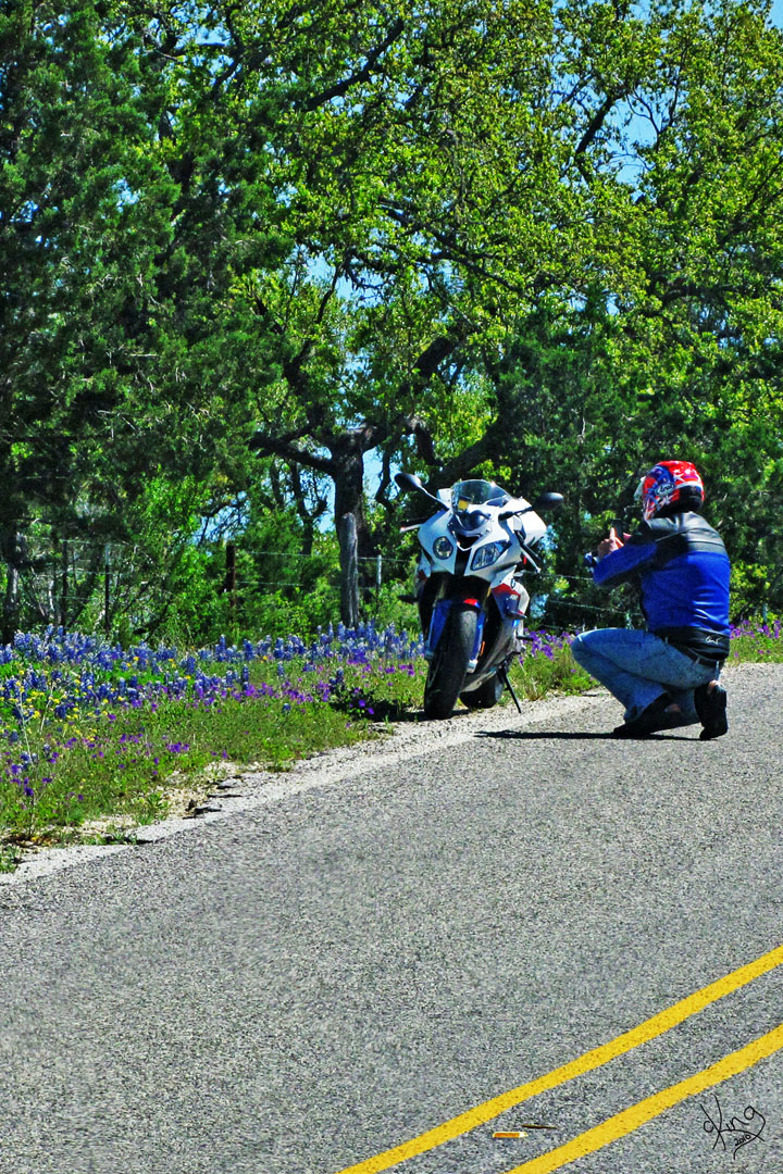
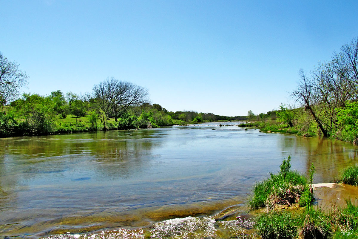
After crossing the Pedernales River not long before reaching 290, we pulled over to study the map. While we were stopped, we watched a guy stop to take a photo of his 'baby' in the bluebonnets... (AND hoped we didn't watch him get squished by a car coming over the hill.)
Directions: And then we reached Hwy 290. See final map below.
|
Pedernales River |
|
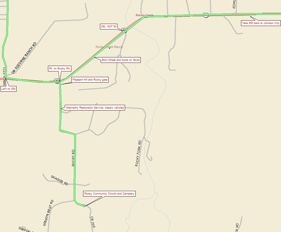
Map of Hwy 290 to Rocky and then home... We were getting ready to start heading back to Austin, but couldn't resist one more side trip when we saw Rocky Road. You may not be heading to Austin and could always turn right on 290 to go to Fredericksburg... or wherever you need to roam next.
Directions: We turned left onto 290 off of FM 2721 (or RR 1320) to head East towards home. But right away after turning onto 290, we spotted Rocky Road going off to our right and decided we MUST see where it took us. |
Click map for last leg...
|
|
Rocky Road
Rocky Creek, Texas - Handbook of Texas
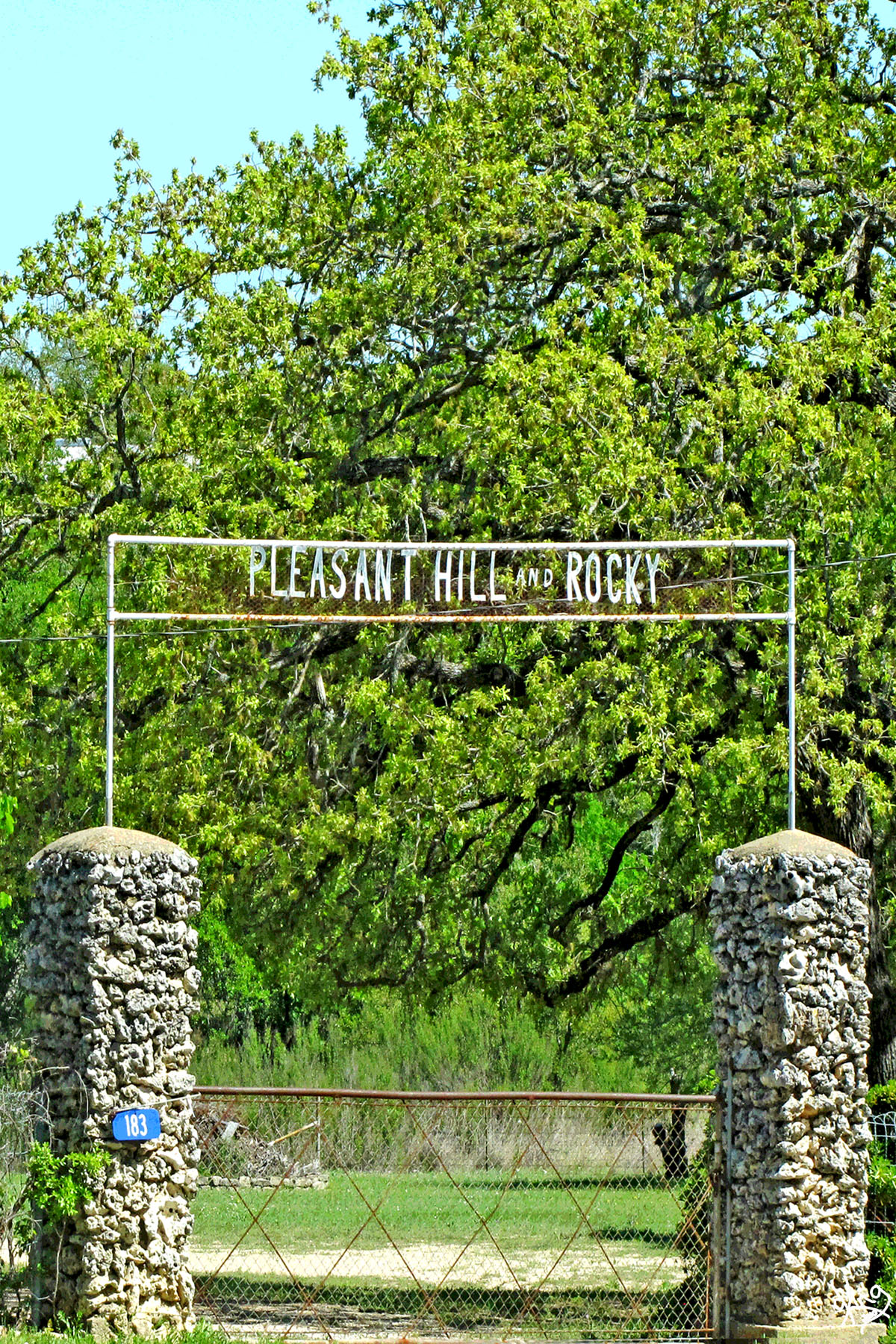
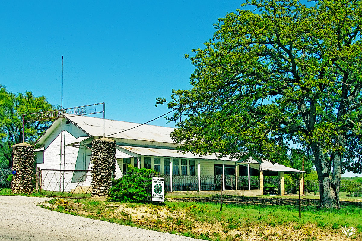
One of the first things we saw was a gate that said 'Pleasant Hill and Rocky' near a building that looks like it might be used for a community center of some kind, but found no signs about the building... was probably the school.
And Jimmie found what HE wanted for Christmas this year... at Abernathy Restoration Service along Rocky Road.
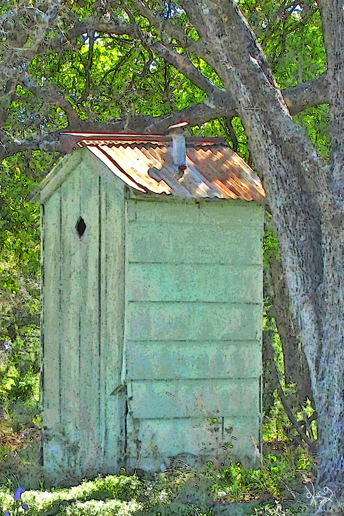
We pulled into the Rocky Community Church, did the photo thing, noted their cute outhouse, and decided we'd better turn around before the sky turned off its lights..
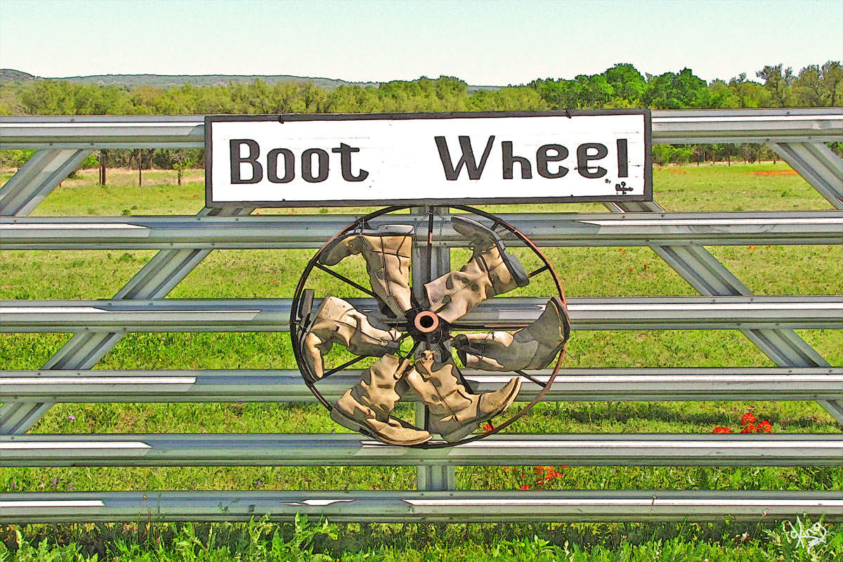
Directions: We turned around at Rocky Community Church and headed back on Rocky Road to Hwy 290, (making a note to come back and follow Rocky Road all the way to Blanco sometime). We turned right on Hwy 290 to head east. Pretty soon we spied the "Boot Wheel" on the right... don't miss it!
|
Rocky Road
Abernathy Restoration Service
Rocky Community Church |
|
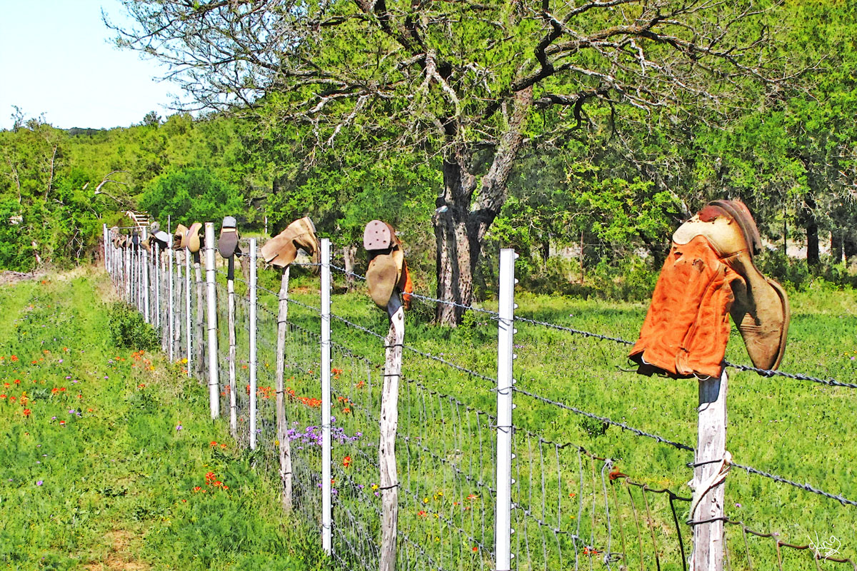
The Boot Wheel (and boots on fence)
The boot decor finds were a perfect final touch to our perfect day!
Directions: We followed Hwy 290 east back through Johnson City and turned right onto Hwy 281 to head south in order catch Hwy 290 east again and home to Austin.
|
|
|
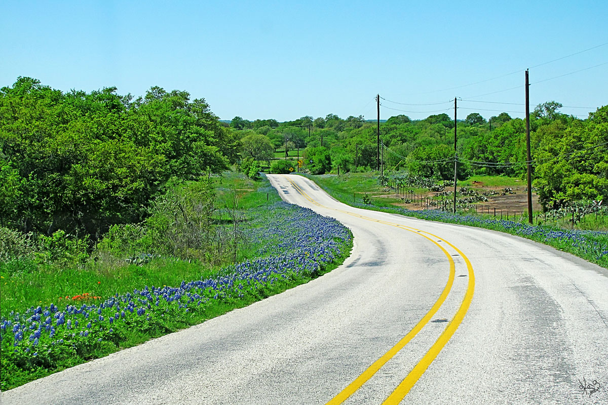
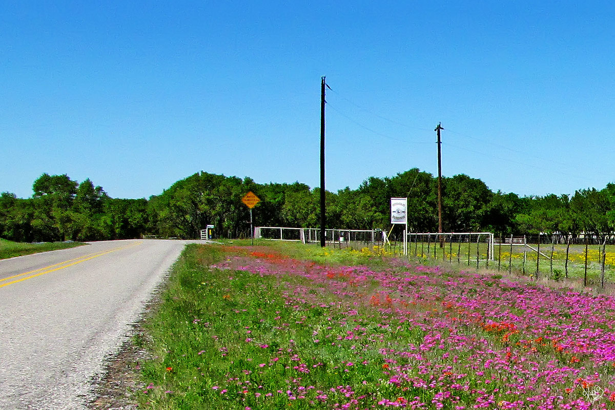
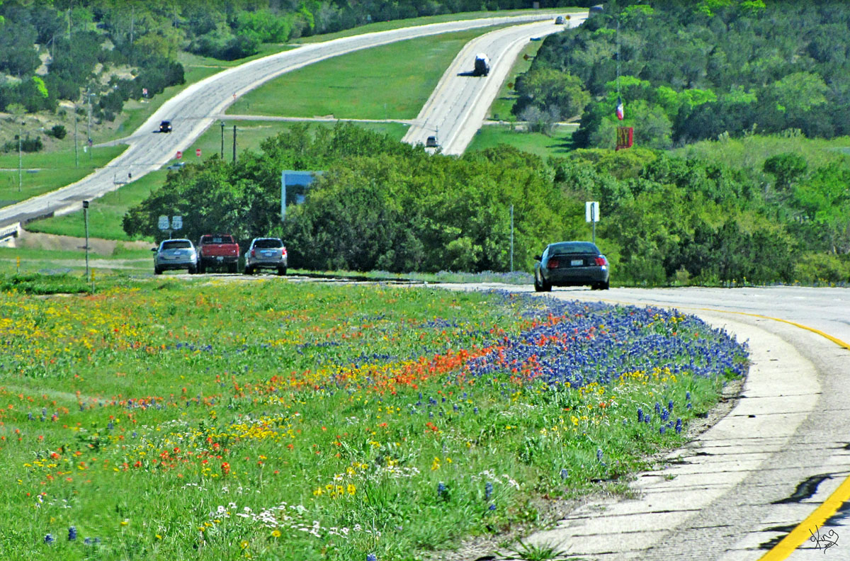
Highway 281 South Thanks to Lady Bird for helping to make both our back roads and highways into a spectacular display of color in the Spring! That's Highway 281 over there.
Directions: From Hwy 281, we turned left on Hwy 290 and headed home! |
|
|
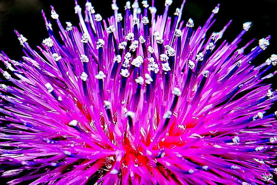
The Result... Me officially O.D.'ing on Texas Wildflowers.... :) And I'll do it again. I think I might be an addict. Enjoy!
AND, one last one.... lest you think bluebonnets steal the whole show...
|
Postcard, Note Card, or Wall Prints
|
|
THE END
P. S. I would be thrilled to hear about your adventures if you try this route! Carol A. King |
|